
Towering to a height of 14,410 feet above sea level, Mount Rainer stands as an iconic symbol of the Pacific Northwest. The majestic snow covered mountain has twenty-five named glaciers — the most of any peak in the continental United States. It is a place where rivers begin, wildlife thrive, and summer wildflowers light up the subalpine meadows. It is a special place where the spirit of the mountain beckons and many heed its call. Mount Rainer National Park welcomes nearly two million visitors per year.
Lost in its beauty, however, is the fact that Mount Rainer is an active volcano. Looming high above densely populated cities, it is considered by geologist to be the most dangerous volcano in the U.S. Though it has been resting for the past 500 years, frequent seismic activity and an active hydrothermal system is an indication of its potential for destruction.
We set out to see this natural wonder and arrived at the Nisqually Entrance on a Saturday morning. The timing of our visit was not ideal. Located near the cities of Seattle, Tacoma, and Portland, the park attracts a great many weekend visitors — especially in the summer. We got stuck in a long line of cars at the gate. We usually try to avoid weekend visits to popular attractions, but in this case, we decided to pack our patience, don a smile and hope for the best.

Once through the gate, we joined a parade of vehicles seemingly all racing to the same destination. Up we went on a winding road passing many points of interest and scenic overlooks. We told ourselves we would come back to them later. The Henry M. Jackson Visitor Center is where many of the popular trails begin and is also the location of the historic Paradise Inn built it 1916. The parking lot is said to fill quickly and we wanted to get there ASAP.
When we arrived we found a barricade and sign saying the parking lot was full. A ranger was directing us to the picnic area where another ranger motioned us to turn down a side road. It was a chaotic scene with cars trying to get in the remaining few spots at the picnic area. Luckily we found one, although the 3/4-mile uphill hike to the visitor center was not part of our plan.
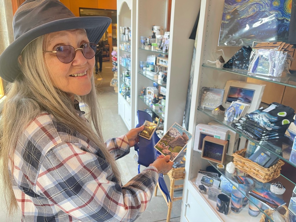
After catching our breath, we went inside the visitor center store and picked out a souvenir refrigerator magnet and a post card to mail to the grand kids.
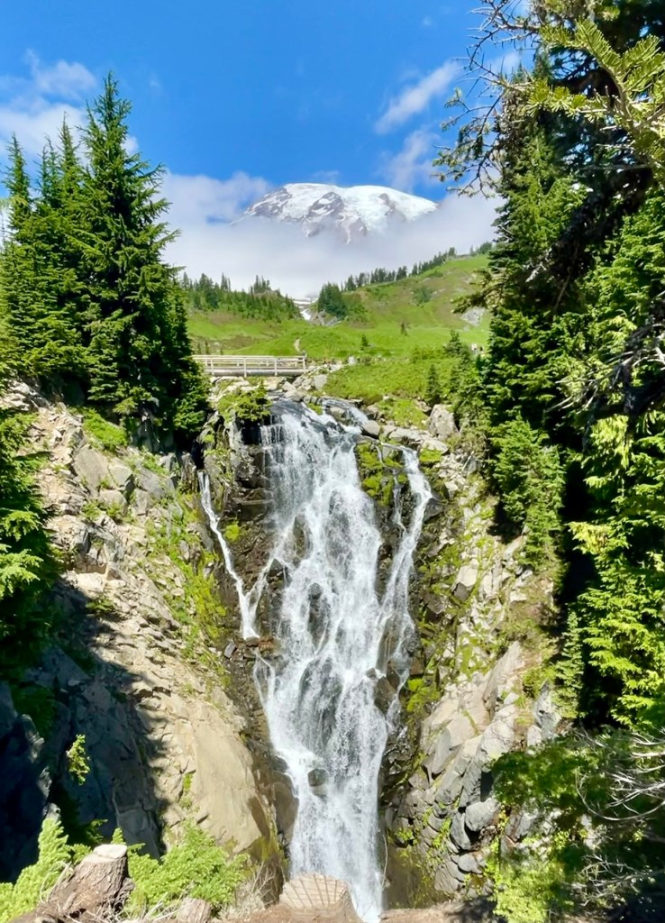
Then after talking with a park ranger, we decided to do the hike to Myrtle Falls. We passed by the historic Paradise Inn and admired the rustic architecture.

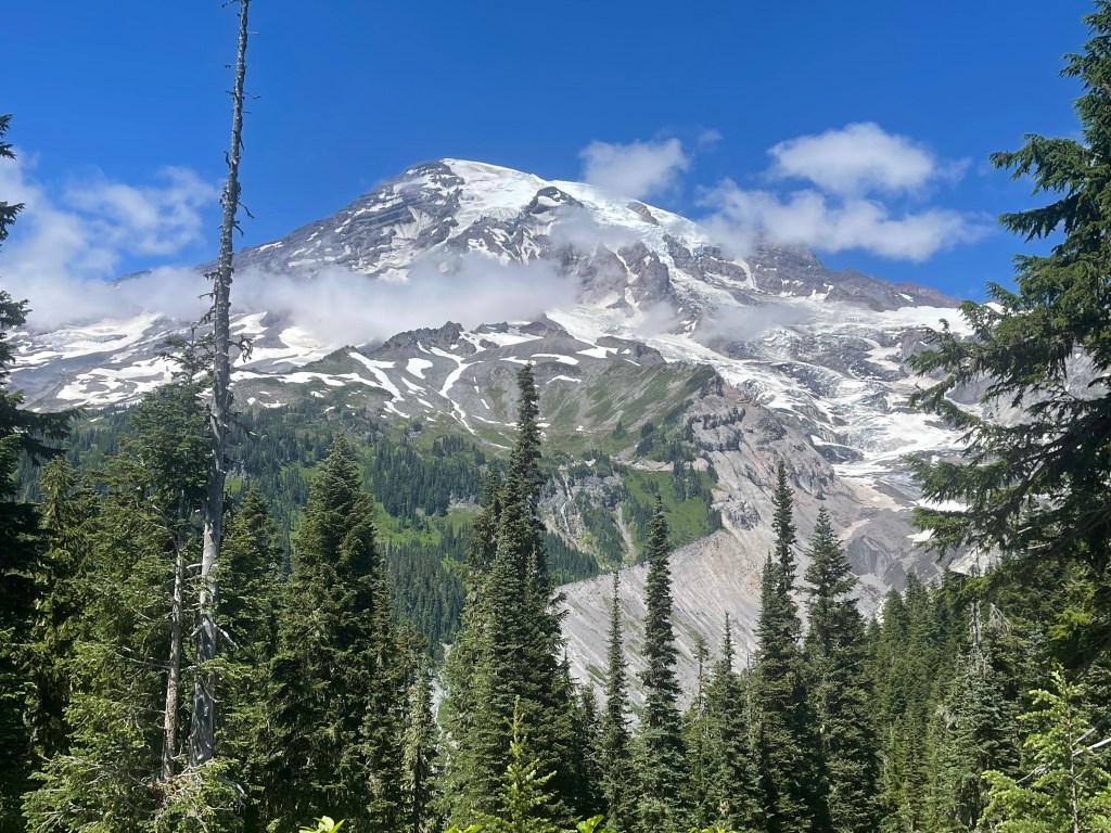
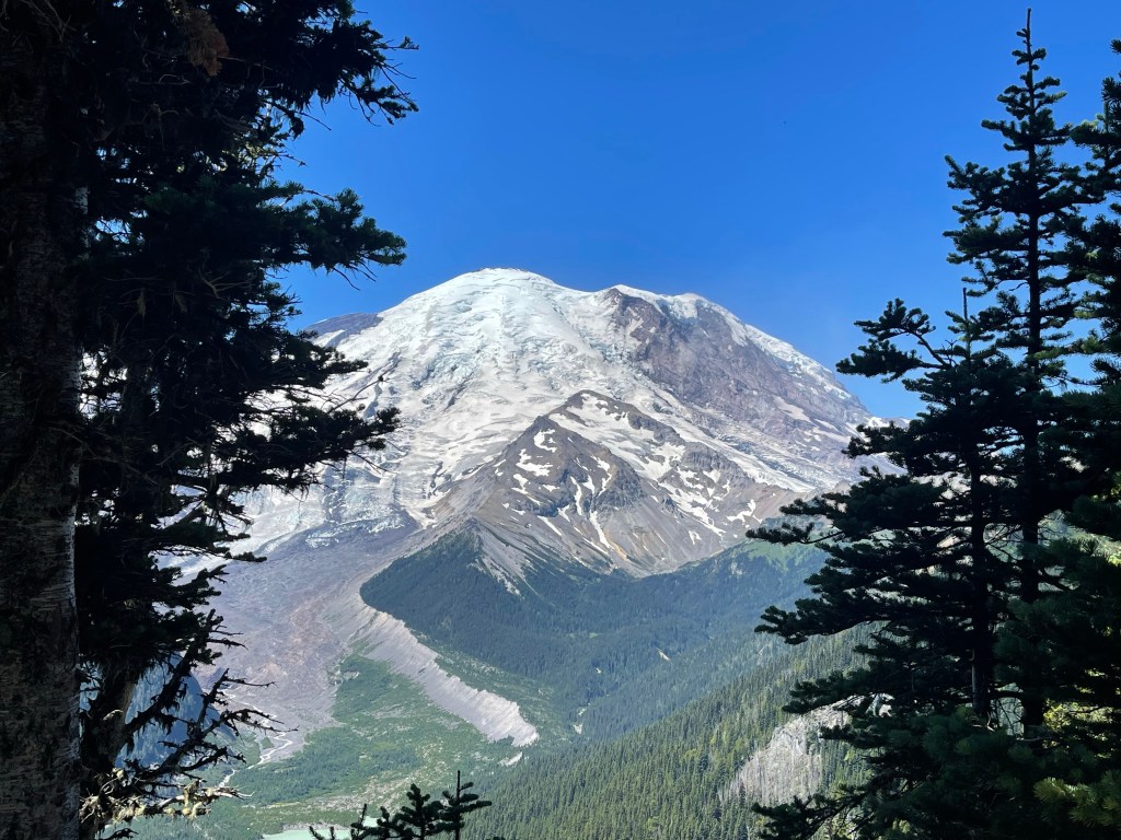
As we ascended the trail, Mount Rainer was playing hide and seek with the clouds, but whenever it made an appearance we would stop to take a photo.

The viewing area for the waterfalls was crowded. But why wouldn’t it be? Where else can you see a waterfall with a snow covered mountain as the backdrop? It was stunning.
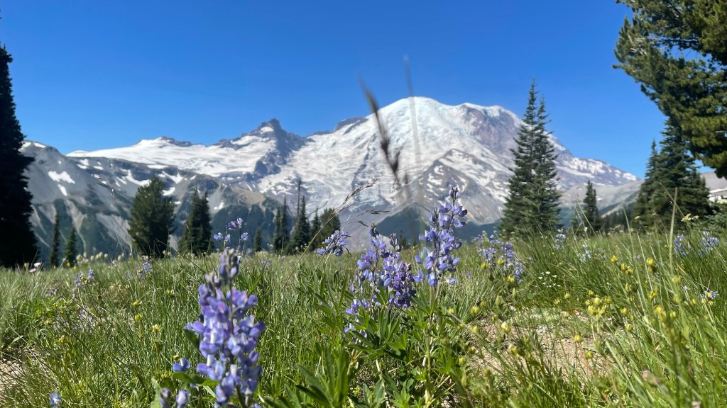
We strolled along the trails for a couple of hours as the clouds slowly gave way to blue skies. It certainly had that “WOW” factor. I thought this would be the perfect time for a picture at Reflection Lakes. Probably the most popular photo location in the park, it is a place where views of Mount Rainer are reflected off the lake. I first learned about this spectacular view from a blog I follow — Travel Explore Enjoy
As we pulled away from our parking spot, I hoped we would find another at Reflection Lakes. I could hardly believe the number of vehicles parked along the roadside. It seemed to go on for a couple of miles. As it turns out, the spot we had was not so bad.
We did find a spot to park at Reflection Lakes. Photographers with cameras on tripods were jockeying for the perfect location. I stood and observed for a moment before choosing my spot. We had to climb over the snow to get to the edge of the water. It was slippery and we were careful not to fall. A breeze rippled the water making the conditions less than desirable for the photo, but patience paid off and I was happy with the results.


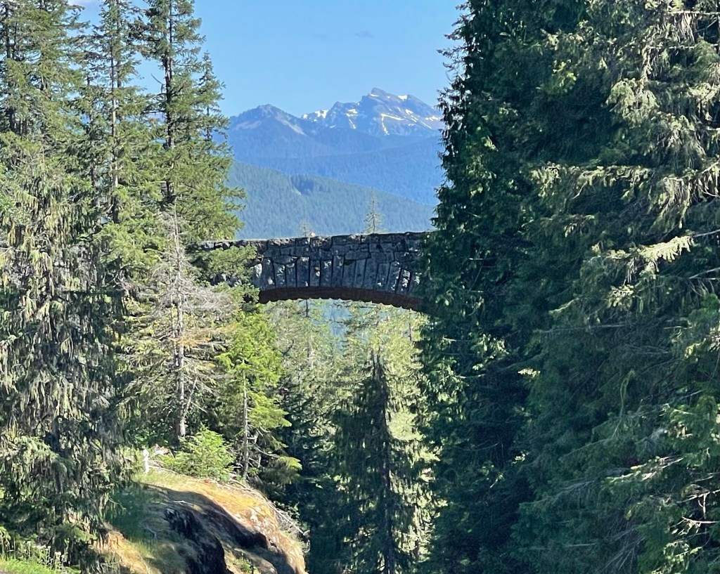
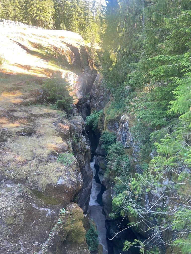
We continued along the Stevens Canyon Road to Box Canyon. We went through a tunnel and crossed over a bridge to find the parking area. We walked out to an overlook to see the narrow slot canyon and the view of the stone arched bridge. We hiked the Box Canyon Loop Trail that follows along the edge of the canyon and crossed a foot bridge where we could look down into the canyon where sunlight seldom shines.
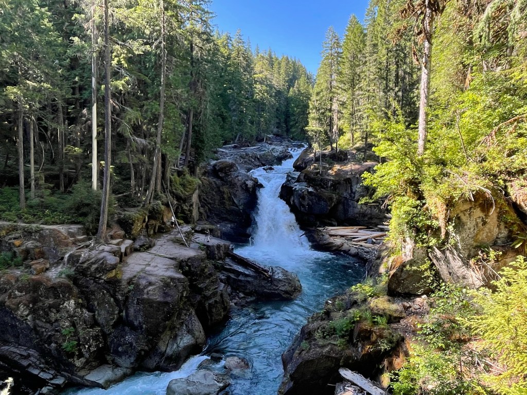
We turned back toward the park’s entrance gate stopping at some of the points of interest and overlooks that we bypassed earlier that day. One in particular that we enjoyed seeing was Narada Falls. It seems we are drawn to waterfalls. This one did not disappoint. It was quite the sight.

We spent a second day in Mount Rainer National Park. This time making the longer drive from our campsite in Morton to Sunrise Visitor Center. We got an early start so we could arrive before the midmorning rush. Again…we drove straight to the visitor center bypassing many of the things we plan to see later in the day. And again…we went inside the visitor center’s store — this time to buy a t-shirt.

It was a beautiful clear day and I was excited to see Mount Rainer against a blue sky. We chose one of the many trails originating from Sunrise Visitor Center. The Silver Forest Trail meandering through flowering meadows with spectacular views of the mountain was reminiscent of a scene from the Sound of Music. I think I heard Julie Andrews singing The Hills Are Alive. The view of Emmons Glacier was awe inspiring. Covering 4.3 square miles, it has the largest surface area of any glacier in the U.S.
The Silver Forest Trail was not our only hike that day. We also hiked Grove of the Patriarchs Trail and Silver Falls Trail. On the Grove of the Patriarchs Trail, we crossed a suspension bridge over the Ohanapecosh River. This bridge is narrow, bouncy, and swings back and forth when you walk across. A sign states that no more than one person at a time on the bridge, but we saw more than that. After we crossed the bridge, there was a boardwalk that loops under the canopy of giant cedar trees. They were huge.

The Silver Falls Trail was our most challenging hike of the day but it was well worth it. With about a 700 foot elevation gain, it gave us a workout. Following along the Ohanapecosh River we came to a roaring waterfall. The falling water actually looked silver against the blue-green hue from the forest’s shadows confirming it was appropriately named. A foot bridge crossing the river was the best place for viewing.
There is a lot to see and do at Mount Rainer National Park like biking, camping, fishing, sightseeing and more, but hiking seems to be the main attraction. There are trails for all skill levels. For the more adventurous, backpacking up to the ice and beyond to the summit is possible. For us, the adventures described above was more than enough to satisfy our desires. We had a great time exploring this park.
Until next time — happy days and safe travels.

Beautiful pictures! You really had a great trip!
LikeLike
Interesting, especially since we were supposed to be there this summer and didn’t make it! I’ll keep your blog in mind when we do go.
LikeLiked by 1 person
Beautiful! Mt. Rainer is definitely on my bucket list.
LikeLike
What beautiful scenery! I couldn’t decide what I liked best. First, I thought Myrtle Falls. Then those giant Cedars were quite impressive. I can almost breath the fresh air. Box Canyon (especially the overlook bridge photo) and the Reflection photos were beautiful, too. And, of course, the Narada Falls. The only photo which carried disappoint was the line of cars. But, who can blame all for wanting to see such beauty? Lastly, I did not realize Mt. Rainer was an active volcano. Thank you for the glorious tour. Safe travels!
LikeLiked by 1 person
Stunning pictures!
LikeLiked by 1 person