
We set the camper up at another municipal park, this time at Gust Backstrom City Park Campground in Morton, Washington. Municipal campgrounds are often overlooked by many RVers, but we have learned they are a great option. Built with local tax dollars for the enjoyment of local residents but open to all, these parks often offer more recreational amenities than state and national parks. Basketball courts, tennis courts, baseball and soccer fields, frisbee golf, paved bike trails, swimming pools, picnic areas with pavilions, and playgrounds are just a few of the things we have seen at municipal parks. Many times these parks are near a body of water like a lake or river. We have a lovely shaded site next to a creek. It is a great location for exploring this area of the Cascade Mountains.
It was a cloudy day when we went to visit Mount St. Helens National Volcanic Monument. Not ideal for viewing an 8,366 foot high volcanic mountain, but we hoped for the best. Mount St. Helens obtained notoriety on May 18, 1980 when a 5.1 magnitude earthquake resulted in a lateral eruption of the bulging mountainside triggering a massive debris avalanche. It was the most costly and devastating volcanic eruption ever recorded in the United States. Fifty-seven people lost their lives that day. Details are vague, but I remember the news coverage leading up to and after the volcanic eruption. I remember seeing pictures of the miles and miles of fallen trees and of the ash that blanketed the nearby towns. It was, of course, big news.
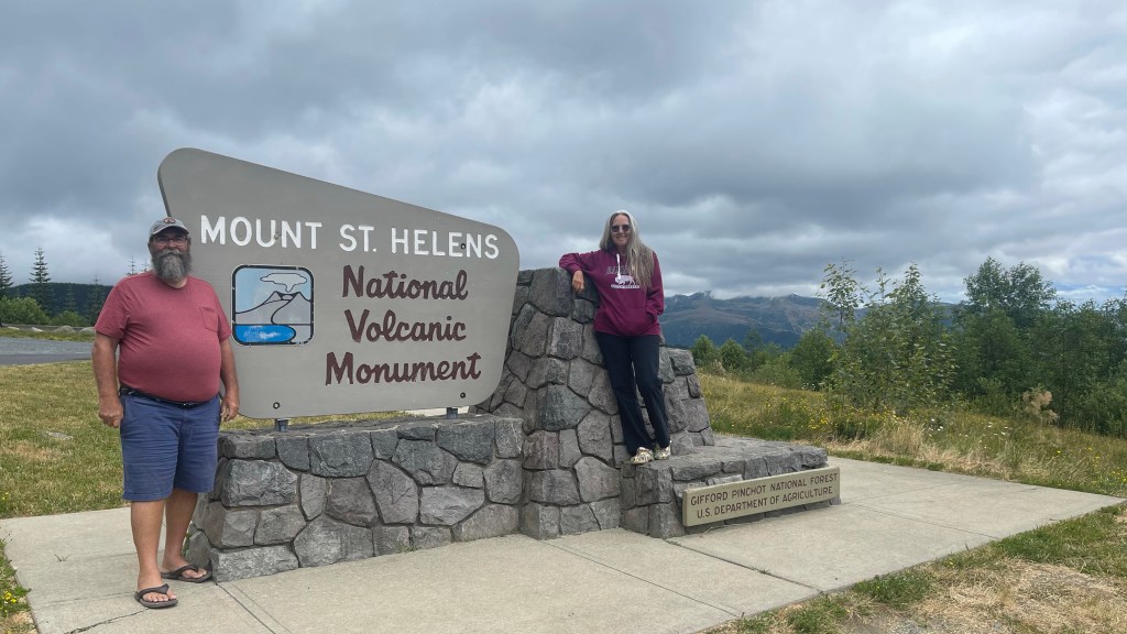
I wanted to reacquaint myself with the events of that fateful eruption by stopping at a couple of visitor and learning centers located along Highway 504. There are four. We began our journey up Highway 504, now designated Spirit Lake Memorial Highway, by stopping at the Mount St. Helens Visitor Center. It’s a Washington State Parks facility located 30-miles from the volcano. We soon learned, however, the facility was closed due to “construction and renovation”.
So we continued along the highway toward the volcano where we came to the Hoffstadt Creek Bridge. One of fourteen bridges along the Spirit Lake Memorial Highway, it is the tallest highway bridge in Washington at 370 feet above the namesake creek below. A parking area and viewpoint on the west side of the bridge is where we stopped for the iconic view.

We then went on to the Forest Learning Center. It is here where a partnership between Weyerhaeuser, Washington State Department of Transportation, and Rocky Mountain Elk Foundation share the story of Mount St. Helens and showcase their efforts in assisting the recovery made over the past four decades. “We should learn something here”, I thought. Well…what we learned was it is closed for the entire 2021 season. No explanation given.
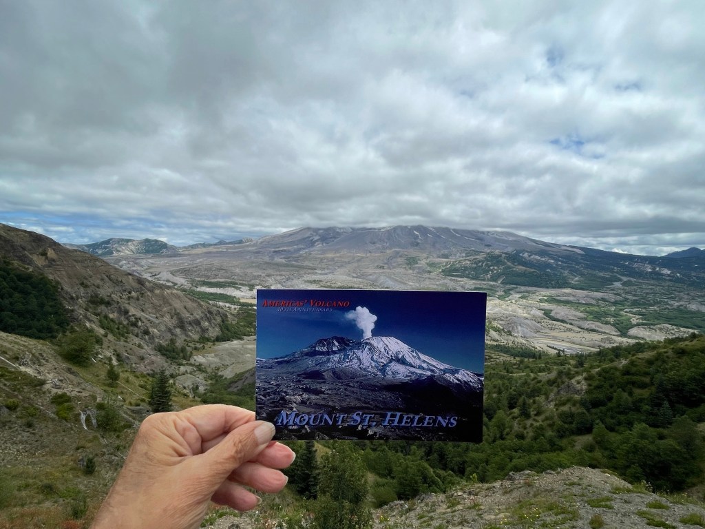
None the less, we joined the crowd of visitors walking around the outside of the Forest Learning Center where there is an overlook with a wide view of the North Fork Toutle River Valley. Information panel boards describe the landscape and highlight the changes. Evidence of the volcanic avalanche is still apparent in the valley. We also got our first look at Mount St. Helens or should I say the bottom section of it. Clouds covered the upper one-third of the mountain. A little further up the highway was the Elk Rock Viewpoint where we made a good-humored comparison of our view to a post card picture.

Continuing to the end of the scenic Spirit Lake Memorial Highway we found a large parking area. There was a crowd of people and we saw tour buses parked in the lot. The Johnston Ridge Observatory is located on the blast side of Mount St. Helens. A sign posted near the entrance to the visitor center reads, “STORE OPEN, VISITOR CENTER STILL CLOSED”.

At least the observation deck was open. It’s a great viewing location on a clear day. Though it was not a clear day, we felt it was still a spectacular sight and have no regrets. The view of the slide zone and the lakes it created was awesome.

We chatted with a couple from Tampa. The man was wearing a Buccaneers T-shirt. They were on a cruise. The ship was docked in Portland for the day and they took the tour bus here to see Mount St. Helen. They didn’t seem disappointed at all about the clouds.
That evening, Grammi and I watched a documentary on Youtube titled Minute by Minute: The Eruption of Mount St. Helens. It is a chronological story about the events and people leading up to and during the eruption. We are now reacquainted. I recommend it to anyone interested in the history of Mount St. Helens’ eruption.
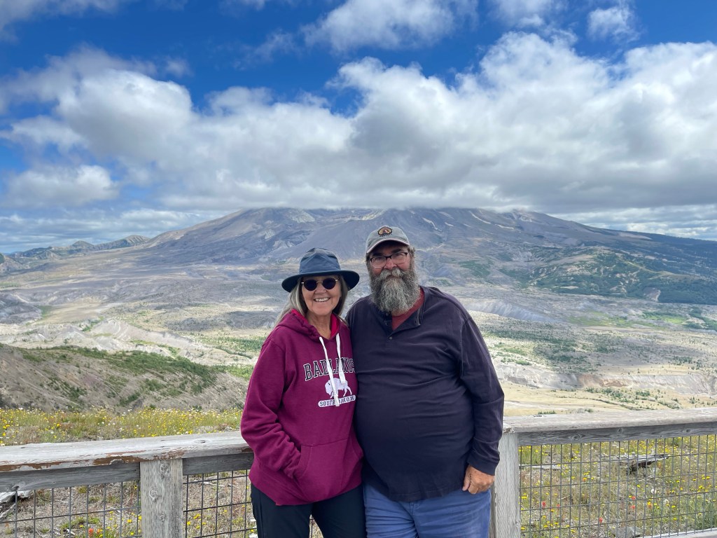
Two days later the skies cleared and we knew it was our opportunity to see Mount St. Helens on a nearly cloudless day. This time we went to Windy Ridge View Point. The Google Map lady thought it best to send us down a narrow one-lane unpaved forest road (NF-26). I have a love/hate relationship with that woman. She is always getting me into uncertain situations. I was hating her at this moment. We survived the drive, albeit barely, and emerged onto NF-99, a paved two-lane road.

The Windy Ridge View Point, just five miles from Mount St. Helens, is much less visited than the Johnston Ridge Observatory. We climbed the nearly 400 steps to the top of the ridge for a panoramic view.

The clear skies allowed us to see all the details we missed a couple days prior. Inside the crater of the volcano is a lava dome said to be still growing. A steam cloud ascends from the top. It was spectacular. We saw Spirit Lake with its mat of floating logs that was swept into the lake during the eruption more than 40 years ago. If you are so inclined, look at the lake on Google Maps to see the thousands of logs still floating in the lake.


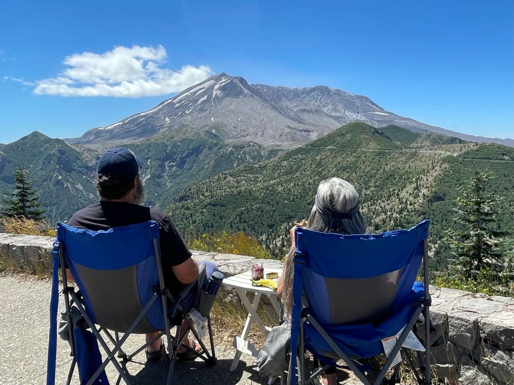
It was so clear that day we could see other snow covered mountains in the distance. We could see Mount Adams, Mount Rainer and Mount Hood. We pulled out our table and chairs so we could sit and have lunch in the beautiful surroundings. It was surreal.
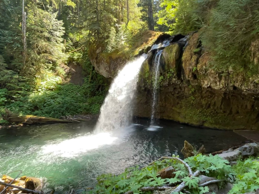
On the way back to camp, we disregarded the Google lady and took NF-99 to NFD-25 where we found a small parking area for viewing a waterfall. Iron Creek Falls was a fun side attraction where we were able to wade in the water and walk behind the waterfalls. It was a very pretty place.

We will stick around Gust Backstrom City Park as we visit Mount Rainer National Park. It is less than an hour away. That will be the subject of our next post.
So until then — happy days and safe travels.

Wow.. Beautiful captures!! Stunting Hoffstadt Creek Bridge!! Great sharing!
LikeLiked by 1 person
Thank you.
LikeLiked by 1 person
I too have a love/hate relationship with the Google maps lady. (We call her Bossy Poots.) Maps has attempted to route us down some potentially dangerous roads. Fortunately, so far, we’ve managed to see the problem (low overpass, no trailers allowed, etc.) before the point of no return and get turned around.
LikeLiked by 1 person
Yes indeed. But I can’t imagine going back to paper maps though. Just getting those folded back up drives me insane. So I will keep her. 😊
LikeLike
What a fabulous post! I remember when Mt. St. Helen’s erupted – I was in college! But, should we visit, I will be sure to watch the Youtube documentary you mentioned – Minute by Minute.
It is more of a mystery to me why stores are open but visitor’s centers are not as compared to the sometimes odd ways Google map takes you. Google is a computer with an imperfect algorithm. Decisions to open a store but not the visitor centers are made by human minds. Yes, human minds are far from perfect, but what could be the logic here?
We’ve only stayed in one municipal park – but we did enjoy it. I will keep my eye out for more.
Now about that Hoffstadt Creek Bridge. There are no cars on it?
In any case, even with illogical decisions and clouds in the sky, you and Grammi sure are seeing some amazing country. I can only hope Dan and I make it to some of the places you are seeing. I look forward to your next post. Safe travels, and enjoy your adventures!
LikeLiked by 1 person
If Google’s algorithm is programmed to aggravate the driver then it is working well. Also, I think 370 Lakeside is a municipal park, at least it is one I thought of when writing this post. As far as the bridge photo, I’ll just say that a little well time patiences paid off. Thanks for your comments. They are appreciated. Have a happy day.
LikeLiked by 1 person
What a great trip. Loved the pictures. I can remember well when that volcano blew its top. Back in the 60s I flew over Mount Pinatubo in the Philippines in an F4. Looking down in that volcano you could see the red lava kicking up. Years later it destroyed Clark AFB.
LikeLiked by 2 people
Wow! I’m sure that was a memorable sight. No red lava at Mt. St. Helens but it would spit a cloud of steam ever so often.
LikeLike
Another very entertaining post with great pictures! I recall when Mt. St. Helen’s erupted. It made an impression. What was goolge doing, sending you down a narrow dirt road? The google lady did the same thing here in Denver, send cars down a one lane dirt road to the Denver Airport! It caused a lot of laughs for those not involved.
LikeLiked by 1 person
Bill – my uncle, who is in the Navy, was at Clark AFB right after Mt. Pinatubo caused all that destruction. I remember looking at the pictures he took and being amazed at the raw power of nature.
LikeLiked by 1 person
Julia, there were two of us flying over Pinatubo that morning. The plane behind us got so low that some of the lava splash came up and hit the radar dome and canopy requiring replacement. I filmed that flight over the volcano, but it was stolen in the development process. At that time Chuck Yeager was our squadron commander.
LikeLiked by 1 person
Wow! It is a shame you had the film stolen! As a kid, I was impressed with Cuck Yeager, but wondered why he spelled his last name wrong…my maiden name is Yager. 😀 The things you don’t realize when you are a kid.
LikeLike