
We completed our quest to see Utah’s Mighty Five when we visited Canyonlands National Park. The largest of Utah’s national parks encompassing 527 square miles, it’s divided into four distinct sections. Our journey took us to Island in the Sky. It’s the most visited district in the park because of its proximity to Moab.
Island in the Sky sits on a mesa high above the surrounding landscape. Sheer cliff walls drop more than 1000 feet toward the Colorado and Green Rivers. Twenty miles of paved roads go to an array of viewpoints with jaw-dropping panoramic views. Miles of hiking trails lead to even more views of Utah’s beautiful canyon country.

The drive along Highway 313 toward Island in the Sky is a picturesque 32 miles from the city of Moab. The lone mesas towering above desert sands and the canyons with steep red walls is a preview of the beauty that lies ahead. Though it was recommended by many people we had talked to, we bypassed the popular Dead Horse Point State Park on this trip and went on to the national park. If we can manage an addition day near Moab, we will certainly make it a priority.

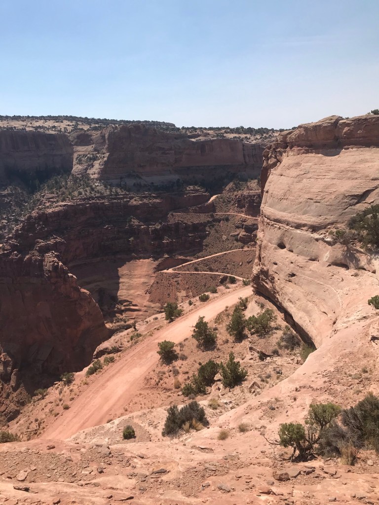
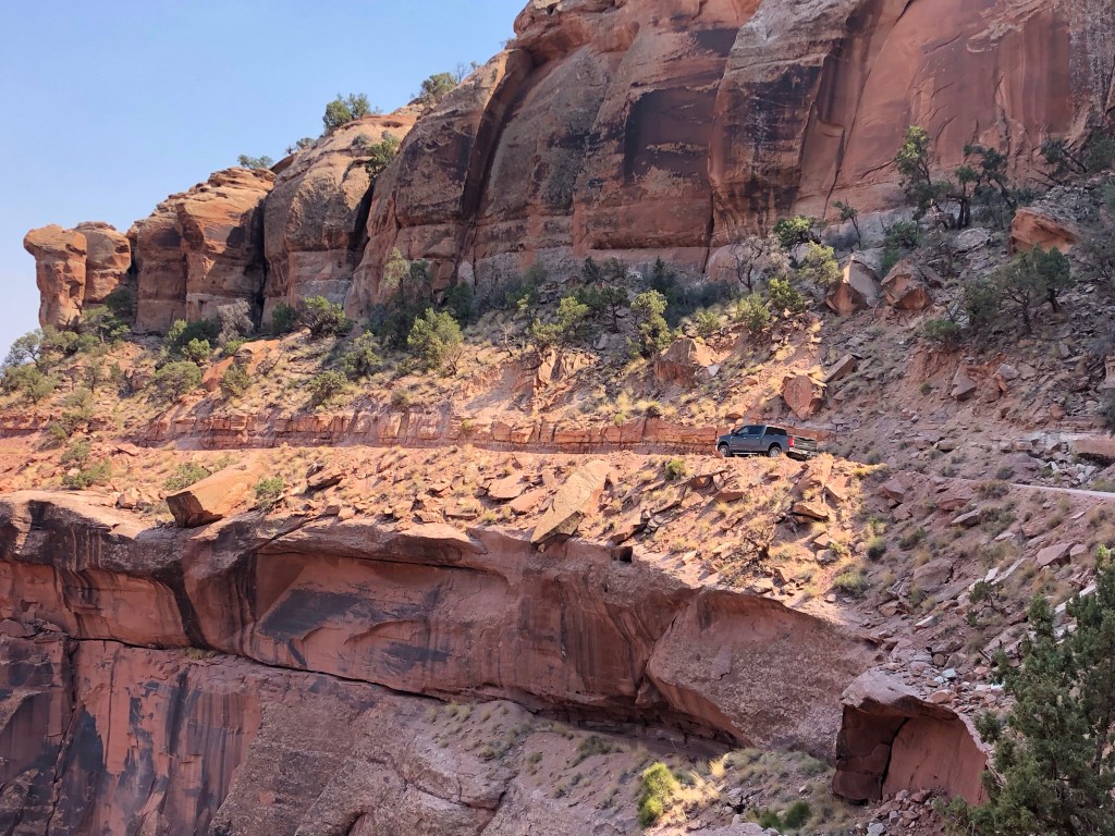
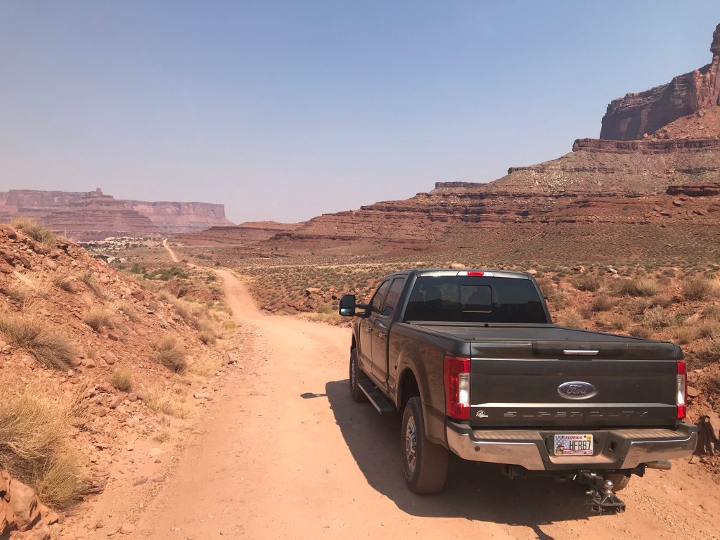
As always, we stopped at the visitor center first. We asked a ranger for tips and must see destinations. He recommended all the popular points of interest but then he went on to tell us about Shafer Trail Road, saying, “if you have a four-wheel drive vehicle you may want to take that road”. “Very interesting”, I thought, “I have a four-wheel drive vehicle”. I followed up with a few more questions for the ranger, “How long of a drive is it?, Can I do it in a pickup truck?, How tight are the switchbacks?, Where does it lead to?”. I got the impression that as long as I have no fear of driving on the edge of a 1000 feet drop off, I shouldn’t have a problem. As it turns out, there are many miles of old unpaved mining roads in Canyonlands National Park that are popular for off-road adventuring.


When we left the visitor center, our next stop was Shafer Canyon Overlook. Standing on the edge looking across Shafer Canyon 1400 feet below was both thrilling and scary at the same time. It caused an uneasy feeling in the pit of my stomach. Smoke lingering in the air from wild fires in Colorado cast a haze obscuring the distant mountains, but the view was spectacular nonetheless. In the canyon below I could see a couple of Jeeps and another four-wheel drive vehicle slowly crawling along the unpaved roads. “Wow! That really looks cool”, I said to Grammi, “We should do that”.
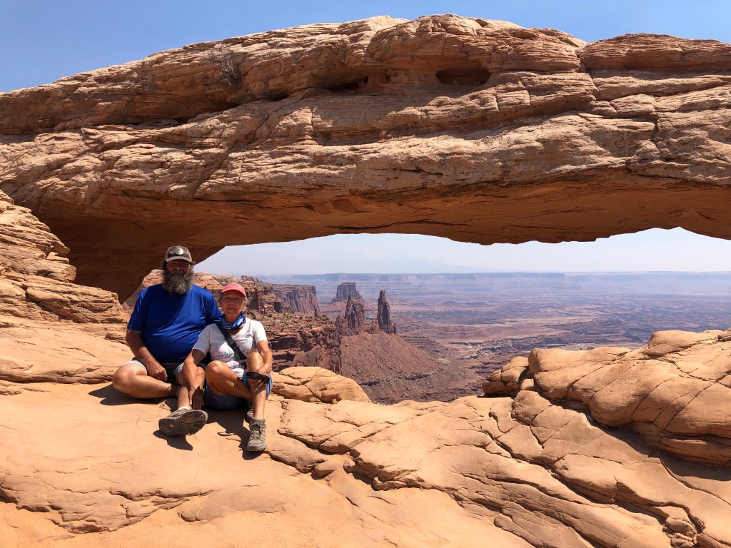
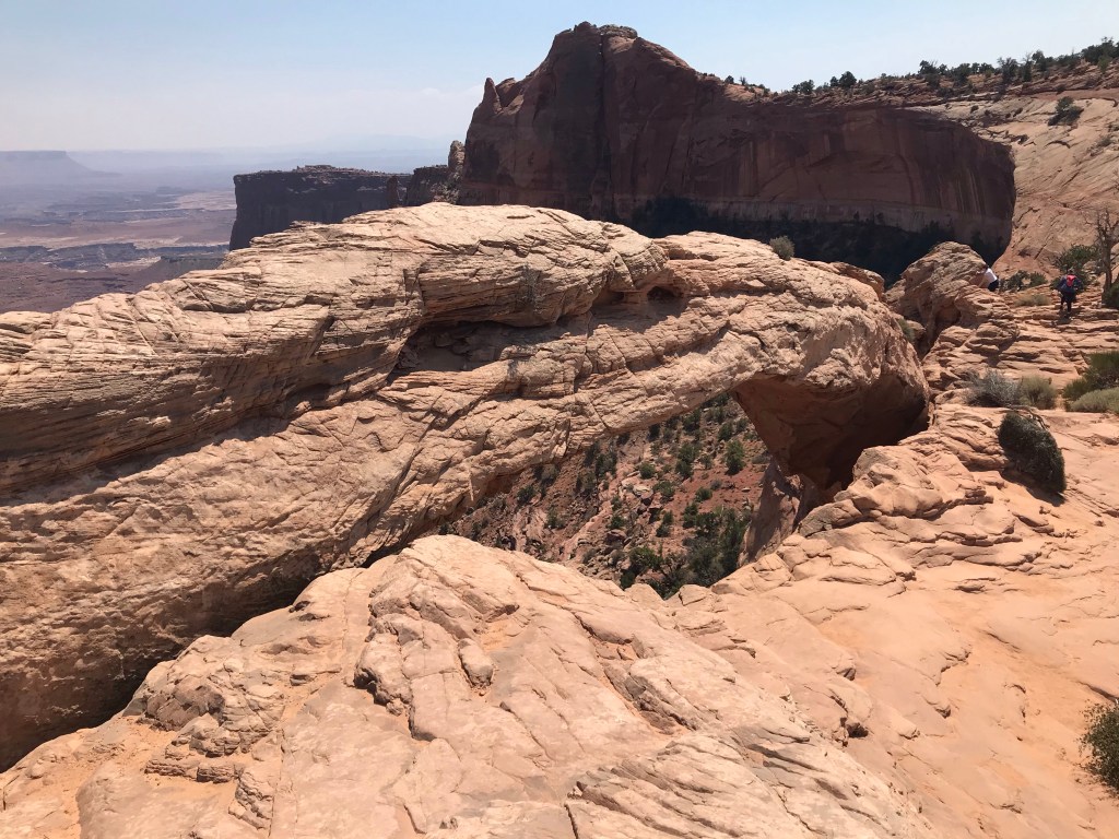
Our next stop was Mesa Arch Trail. This hike is an easy 0.6 mile loop trail passing by one of the most photographed sites in the park. Mesa Arch, a natural stone arch perched atop a cliff, sees thousands of visitors each year. The view through the arch of the early morning sun peaking over the mountains illuminating the distant rock pinnacles towering from the canyon is a much sought after picture by any serious photographer. I am certain you’ve seen that image before. We were there midday. The sun was high in the sky, but I can attest it’s still a wonderful sight to see. We sat and ate lunch as we watched a steady stream of people walk up to the front of the arch near the edge of the cliff, snap a photo, then return from where they came. There were only a hand full of people who spent more than a few minutes at the arch.


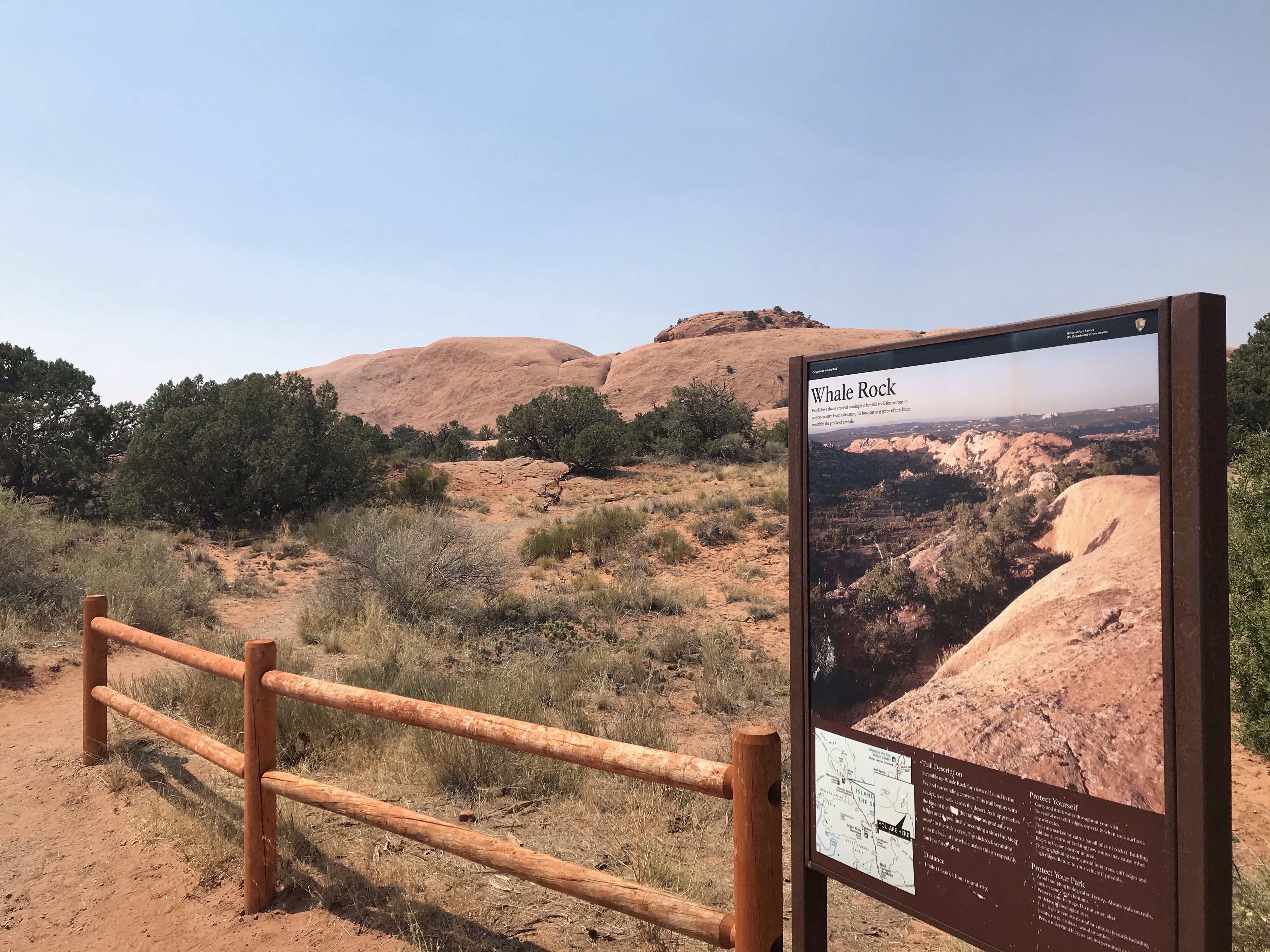
Next we drove to Whale Rock Trail. There’s a popular hike to a rock formation that oddly resembles a whale. When we parked, I looked up at the digital thermometer in the truck. The outside temperature reading was 103 degrees. Yep, the afternoon heat was kicking in. There were no other cars in the parking area. It seemed that no one else was on the trail. It was strange that the crowds had suddenly disappeared. I got out of the truck to read the sign at the trail head. It was a one mile round trip walk to Whale Rock. I was looking forward to climbing up the back of the whale. The 360 degree view is said to be quite stunning. But grammi wasn’t feeling up to a hike in the heat and I guess neither was I. It was just too hot.

The other places we want to see, such as Upheaval Dome and Grand View Point just to name a couple, require a bit of a walk as well. We decided it was best to forego anymore hikes today and plan an early morning return visit. Besides, I was eager to explore the back country roads which we can do from the comfort of the air conditioned truck.

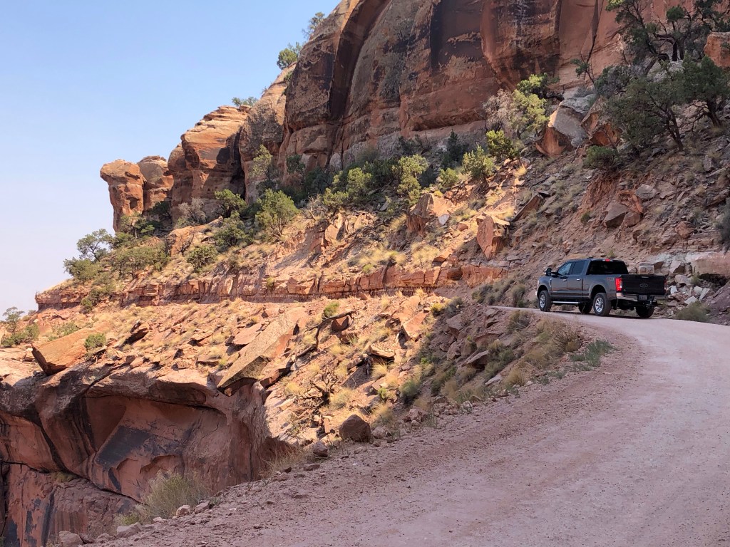
The drive down Shafer Trail Road turned out to be a thrilling experience. It took us 3½ hours to travel the 45 miles to Moab. Of course we stopped often to take pictures and to just look around. This has to be some of the best views we‘ve seen yet. It took some fortitude to maneuver around the switchbacks on the side of the canyon, some of them so tight I had to back up to make the turn. I felt giddy and squirmed in my seat when I looked over the edge.
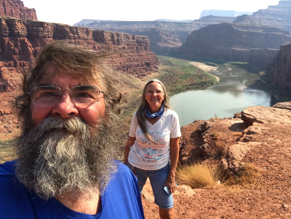
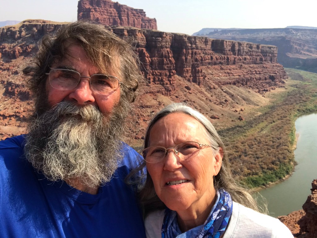
The roads in the canyon were clearly marked. We easily found our turn onto Potash Road heading for Moab. We passed the Gooseneck, which is an 180 degree bend in the Colorado River that reminded me of Horseshoe Bend near Page, Arizona. The difference being we were the only ones there. Unlike the hundreds of people crowding around Horseshoe Bend, Gooseneck was remote. Dead Horse Point Overlook was nearly 1000 feet above us and the Colorado River was 1000 feet below us and we stood on a ledge with the view all to ourself. It’s hard to describe the feeling.

A little further around the bend is Thelma and Louise Point. It’s where the final scene for the movie was filmed, not at the Grand Canyon as the movie portrays. There is no sign marking the location but it is on Google Maps.


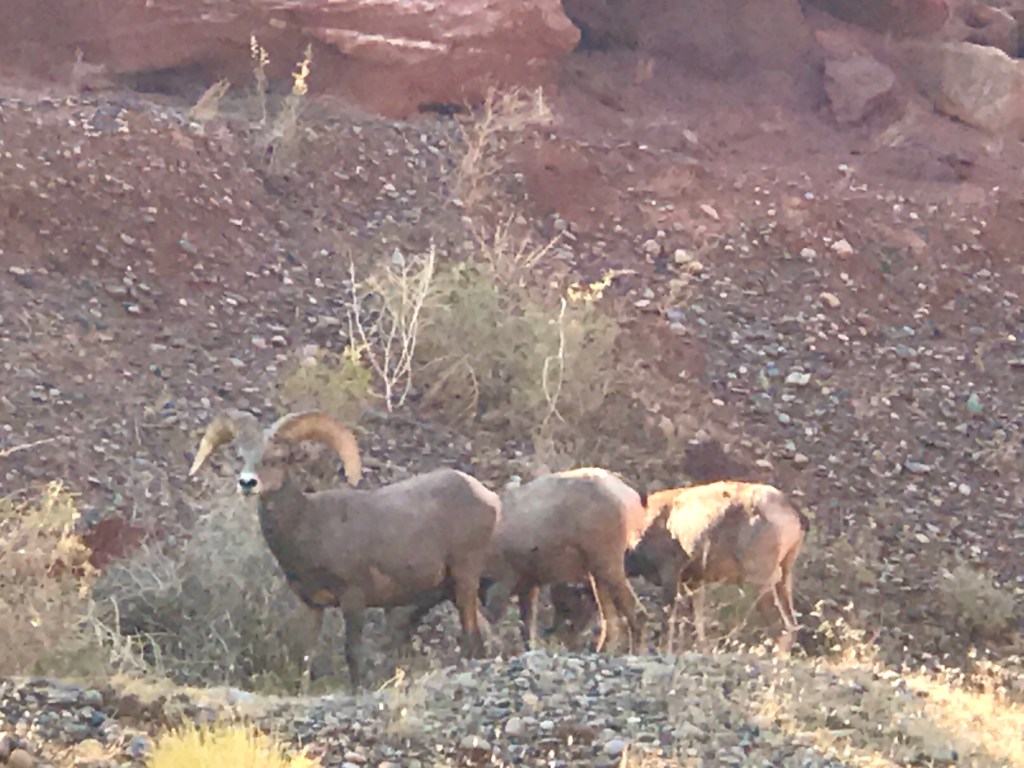
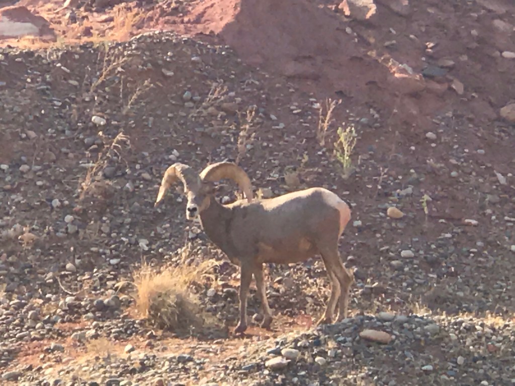
We saw a herd of big horn sheep. We’ve been hoping to see these elusive animals. They weren’t up in the cliffs like you might expect. They were grazing near the road. We stopped to watch them. They weren’t frightened and they didn’t run away, but they were very aware of our presence keeping a keen eye turned toward us.
We drove by some potash evaporation pools. We passed a sign stating we had entered private property, that the road was open to recreation vehicles but warning not to leave to road. The white crystallized salts from the mining of potassium chloride, also known as potash, stands in contrast to the red desert.

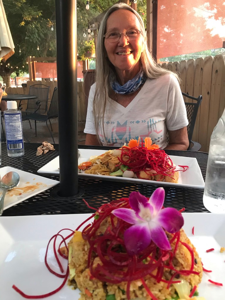
We made it back to Moab around dinner time and after a long day, we wanted to treat ourselves to nice dinner. We went to Thai Bella. We asked for outside dinning and were seated at a corner table on the patio. The service was very good and the food was excellent. We were very happy with everything. It was a fabulous end to a fabulous day.
We never made it back to Canyonlands National Park. What’s that quote about “best laid plans…”? Oh well, those other hikes will have to wait for another time. There was just so much to do and see in the area that we couldn’t get it all done. We spent a total of seven days here and could easily stay seven more. We enjoyed the area around Moab very much, in fact, we’ve enjoyed Utah tremendously. This is a place I want to come back to.
The nasty smoke from the distant wildfires in California and Colorado seemed to get worse every day. Portions of the interstate closed because of the fires. It has caused us to change our plans. Tomorrow we’re going to southern Colorado in an effort to get away from the smoke. I hope it works out.

Until next time…happy days and safe travels.

Great photos! And sounds like a great day. You both are way braver than I am. So, I am happy you drove Shafer Trail and shared your pictures because I never will. Safe travels!
LikeLike
It would be wonderful to live out there. So much to and see. And an off road vehicle would be a must. You are getting your moneys worth out of that truck and RV.
LikeLiked by 1 person
Looks fantastic!
LikeLiked by 1 person