
Our style of camping is to stay flexible and not book campsites too far in advance. We like the freedom this gives us. A case in point is when our daughter came to visit last week, we were able to make adjustments without affecting future reservations. Additionally, we sometimes meet people that recommend places we “just have to see”. However, finding a place to camp is getting harder and harder. Most campgrounds remain fully booked, especially on weekends. The campgrounds that do have vacancies are charging high prices. For us, it means we camp a little further away from the preferred locations.

We are staying at the Ballard RV Park just off of I-70 in Thompson Springs, Utah. We are 34 miles from Arches National Park and 46 miles from Canyonlands National Park. The gateway city of Moab is located between the two parks. We plan to spend some time visiting both national parks and exploring the areas around Moab. With so much to see and do, we booked our site for seven nights taking advantage of the weekly rate.
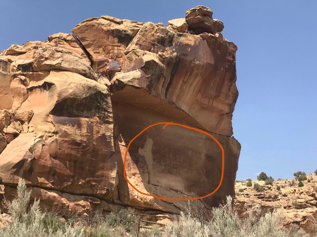
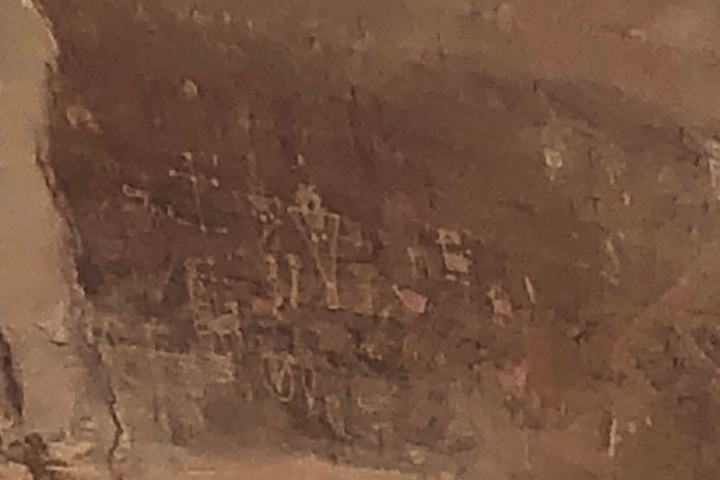
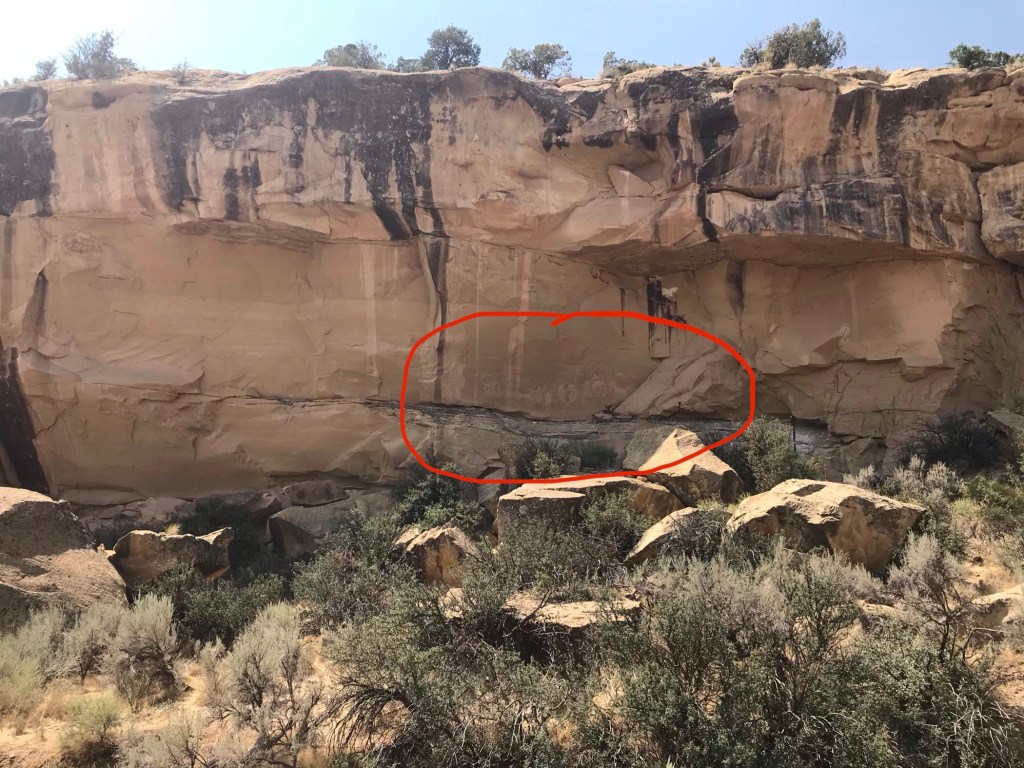
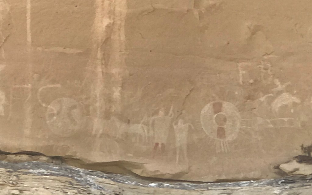
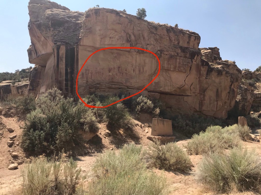
The receptionist at the RV park was very friendly. When we checked in she gave us a packet of information that included several nearby points of interest and scenic drives. She pointed to some of her favorites. We explored one of those recommendations on day one. The Thompson and Sego Canyons are located north of Thompson Springs on BLM159. It’s where many ancient Native American petroglyphs can be found. According to information from scienceviews.com (there is a link at the end of this blog) the petroglyphs in the canyon are examples of three distinctly different styles from different time periods.

Using a hand-drawn map provided by our campground, we drove into the canyon for about 3½ miles where we found a parking area. At the parking area was a pit toilet, the only such facility we found while exploring the canyon. There were footpaths going to the cliff walls where one can get a closer look at the rock art panels. Very little information was posted. The limited number of signs we saw were faded and unreadable. The paths to the cliffs just meandered haphazardly.

Having now seen more than a few examples of petroglyphs, I can says some of these were very impressive, especially the life size human figures. Unfortunately, some others were defaced with graffiti. It was all very fascinating. I just wish there was better information posted describing the origin and history.

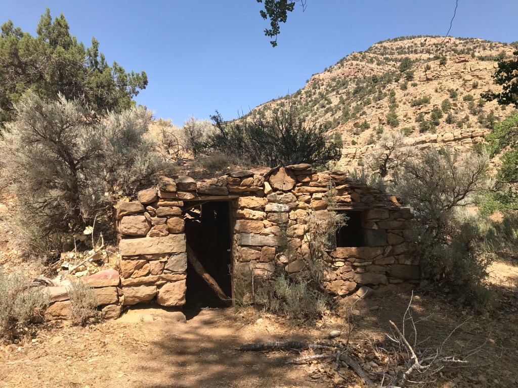
We continued up Thompson Canyon passing the turn to Sego Canyon (we’ll come back to that later) where we came to an old homestead with a dutch oven. The site was marked on the map we received from the campground so I wanted to see what it was.

I couldn’t find any information as to the significance of the dutch oven. A shelter was built over it apparently to protect it from the elements. It was in great condition, appearing to be ready for use. We saw a few more homesteads built from stones but this is the only one with a dutch oven.

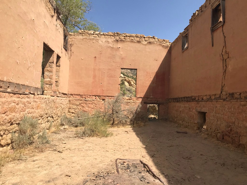
We turned around and headed back down the canyon, this time finally turning east into Sego Canyon to find the Sego Canyon Ghost Town. It wasn’t hard to find, about a mile up the road stood the masonry walls of the old company store. An old rusty car sits near some rotting lumber from the boarding house that, according to the lady working at the campground, collapsed not long ago.


Sego, Utah was another small mining community that sprang up in the 1890’s. This was a different kind of mining town for this area though. It wasn’t a gold or silver mine but rather a coal mine. The discovery of coal by a local rancher resulted in it’s growth and development. In 1914 a railroad spur line was built to transport the coal. However, plagued by water shortages throughout its history, the mining company and the community struggled to survive until the mid 1950’s when the mine was closed and sold to gas and oil investors. Since that time, the buildings have slowly deteriorated, melting into the landscape.

We got out and walked around the site. I’m not sure what we were looking for. Maybe it was just an attempt to get a feeling for what this place once was. Now considered to be a ghost town, knowing that people use to live and work here makes me wonder what it was like. We didn’t walk around too long though. There were lots of hiding places for snakes. Yikes!
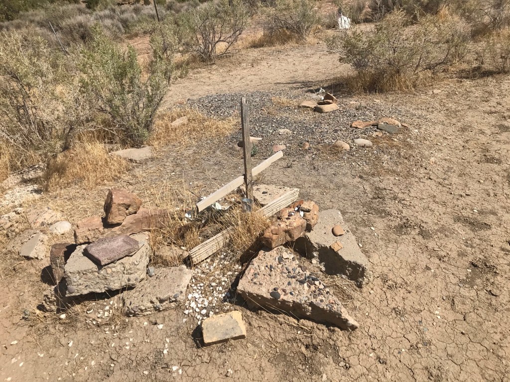
As we drove back out of the canyon, we spotted an old cemetery and had to stop to take a look. It’s a small fenced plot with mostly unmarked graves surrounded by beautiful craggy desert mountain slopes, but yet it’s a somber place. Lost souls, long forgotten, perhaps safeguarding a ghost town also long forgotten in a sacred holy canyon. It’s sobering to think of the thousands of years of history and the many people, both Native American and European settlers, who lived and died here.

Tomorrow we continue the adventure. There is so much to see, so many places to explore. Where to next? Check back soon to see.
So until next time…happy days and safe travels.

The defacing of drawings made many years ago is a terrible act. That area of our country is so full of history and wonderful sites. Walking around all of those stone buildings would require a long stick and high boots for me. I could see many hiding places for snakes.
LikeLiked by 1 person