The Pacific Ring of Fire is a seismic belt surrounding the Pacific Ocean where most of the earth’s volcanos and earthquakes are found. Located along this belt in North America’s west coast are nearly twenty major volcanos with the potential to erupt. Mt. St. Helens’ eruption in 1980 is a significant example.
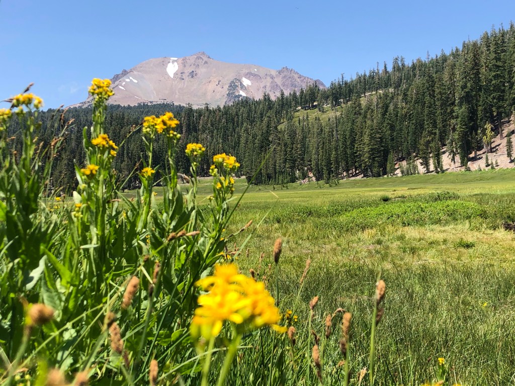
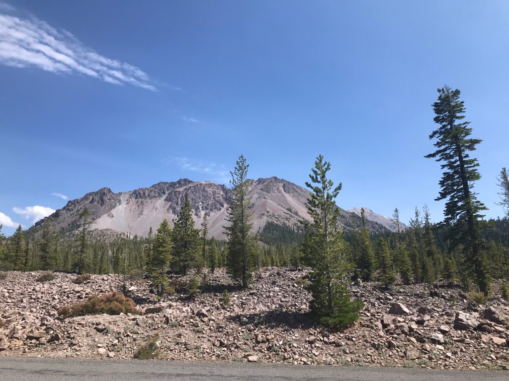
Located on the Ring of Fire in northern California and towering high above the surrounding area, Lassen Peak was a landmark for immigrants traveling west to California. It erupted on May 19, 1915. Lava flows, mudslides, hot ash and toxic gases devastated the area. No deaths were reported from the event but there were many eye-witness accounts.
Already designated a National Monument in 1905 by President Theodore Roosevelt, the area attained national park status in 1916 after the eruption. Today, trees grow where once destroyed, but evidence of the 1915 eruption as well as past eruptions can still be seen. Areas of hydrothermal activity tell you that you are visiting an active volcanic area. Boiling mud pots, fumaroles, and bubbling hot springs are all located within the national park.
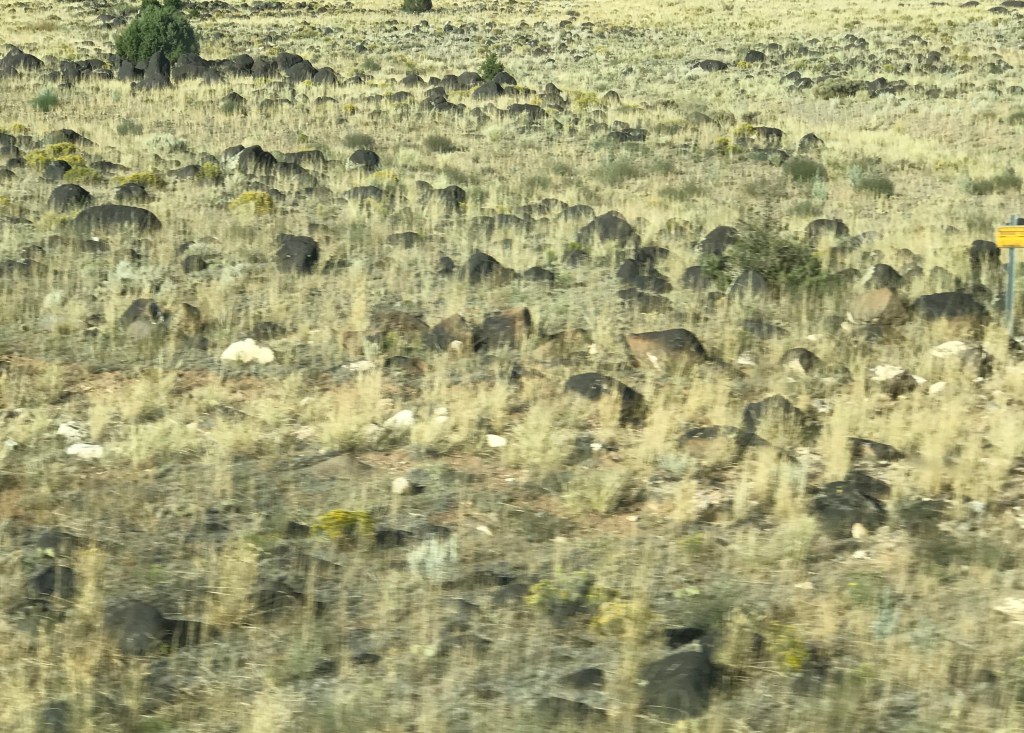
As we traveled part of the Volcanic Legacy Scenic Byway en route to Lassen Volcanic National Park, we started seeing thousands of black rocks scattered around. They were of varying sizes but many were the size of beach balls. I learned from a park ranger they were lava bombs that rained down during the past eruption. Incredible to think these were cast miles away from the site of the volcano.
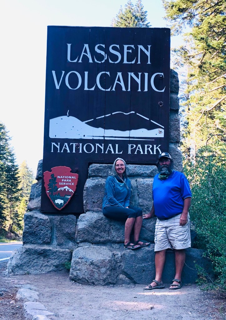
Due to it’s remote location, Lassen Volcanic National Park is one of the least visited national parks. The closest gas station is nearly 40 miles away in either Red Bluff or Chester. However it’s a must-see and a hidden gem among all the national parks. We stayed at a campground outside the park in Mineral. For three full days we explored as much as we could.
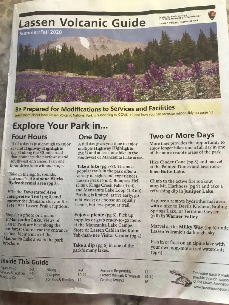
As usual, on our first day we went to the visitor center. The Kohm Yah-mah-nee Visitor Center had an outside information table with a ranger answering questions. He gave us a map and a booklet. The Lassen Volcanic Guide booklet was an excellent resource. It contained highway highlights corresponding to numbered markers along the Lassen Volcanic National Highway, the only road that goes through the park. A brief description of each stop was inside the booklet.
We drove the entire thirty miles of the Lassen Volcanic National Highway from the southwest entrance to the northwest entrance that first day. Using the guild book we stopped at nearly all the highway highlights. Here are some we found most impressive:
Sulphur Works — A boiling mudpot and stinky steam vent near the road. Easily viewed from the sidewalk, it was a quick accessible walk from the parking lot.
Bumpass Hell — The largert area of hydrothermal activity in the park. In 1865 tour guide Kendall Bumpass, while showing the area to a group of people, slipped and fell through the crust. So severely burned, his leg was eventually amputated. The area was named in his honor. From the parking area we did the 3 mile round trip hike. There were many great views along the way. After a steep walk down to the site we arrived at a boardwalk for up close views of mudpots, steaming hot springs and fumaroles. No fear of falling in the hydrothermals here as long as you stay on the boardwalk. The drifting steam, the stench of sulfur, and the eerie gurgling sounds gave me reassurance this place was properly named.


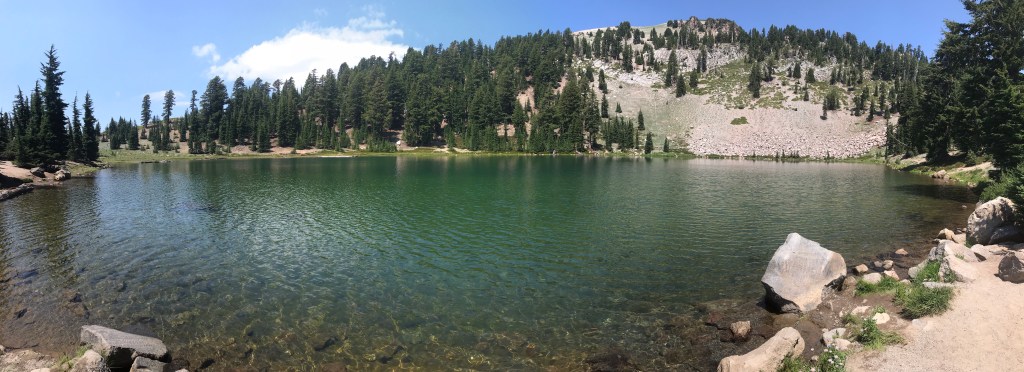
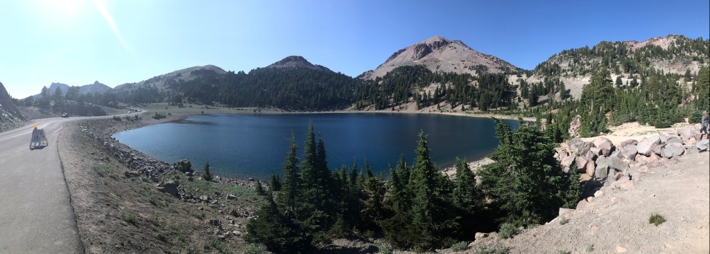
Emerald Lake and Lake Helen — These glacier lakes are frozen most of the year, but now, during the summer, the crystal clear water beautifully reflects nearby Lassen Peak.
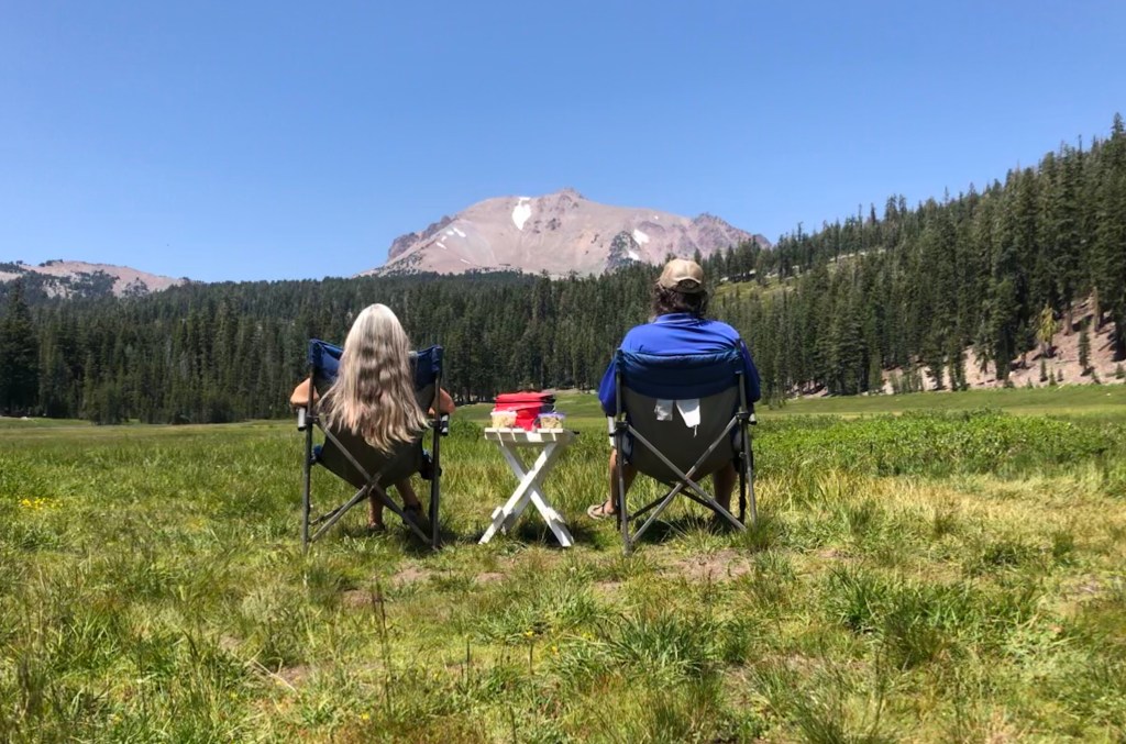
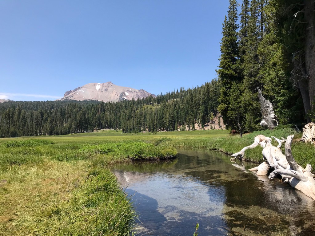
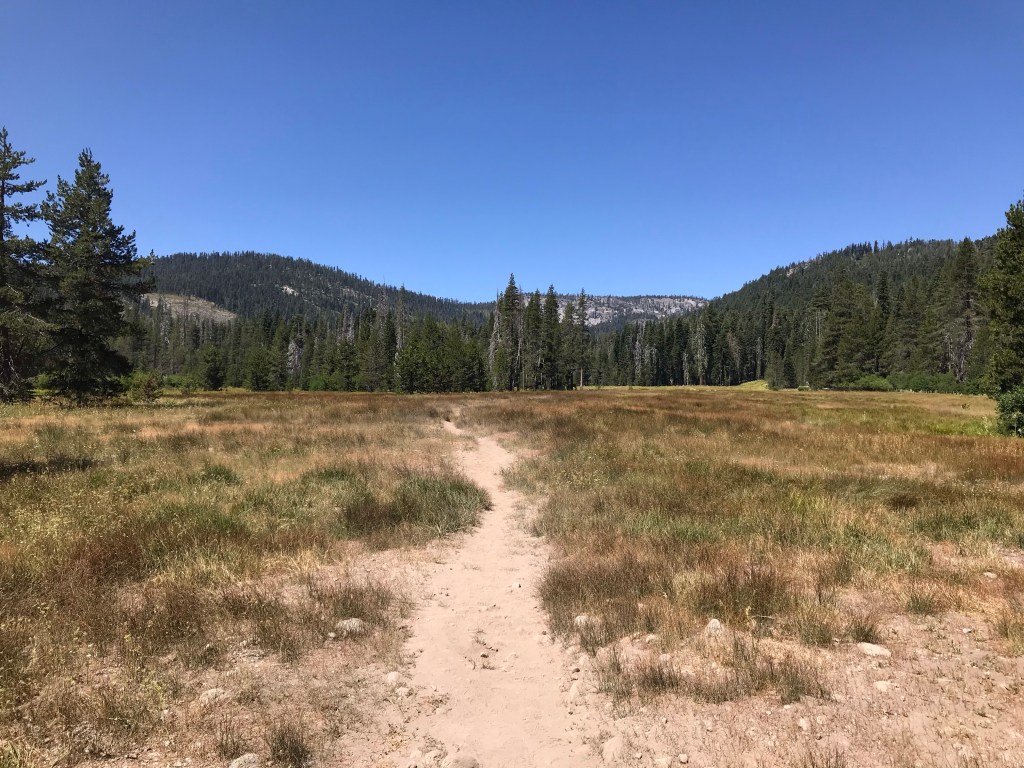
Kings Creek Meadow — Kings Creek meanders through this lush grassy meadow surrounded by mountains. This serene location with sounds of trickling water was our spot for a picnic.
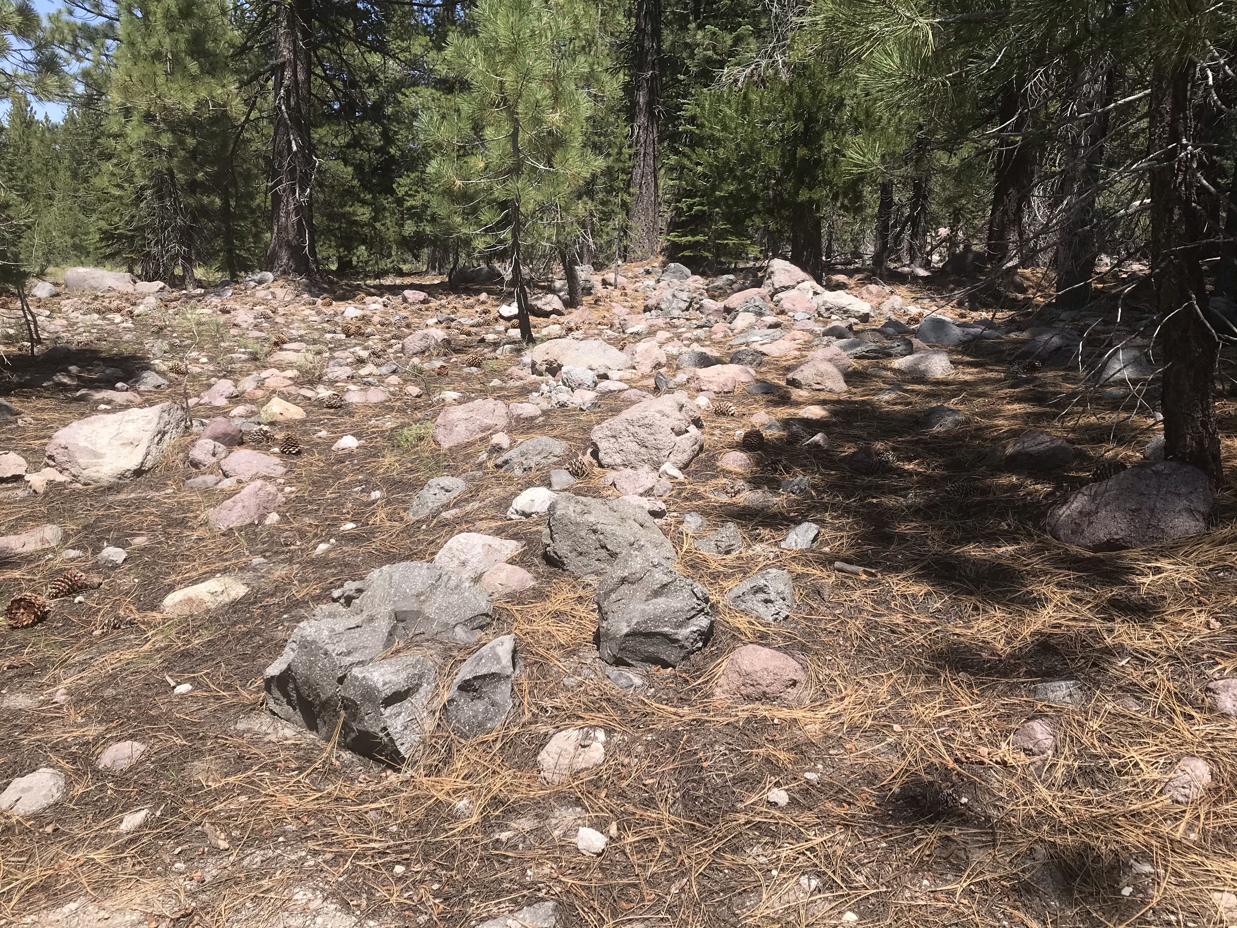
Devastated Area — A short interpretive trail with excellent views of Lassen Peak. Information plaques along the trail describe the devastation left from the volcanic activity. Red and black lava rocks scattered throughout are remnants from past eruptions. We learned the black lava rocks came from the most recent eruption in 1915 and the red rocks are from an eruption 27,000 years ago.

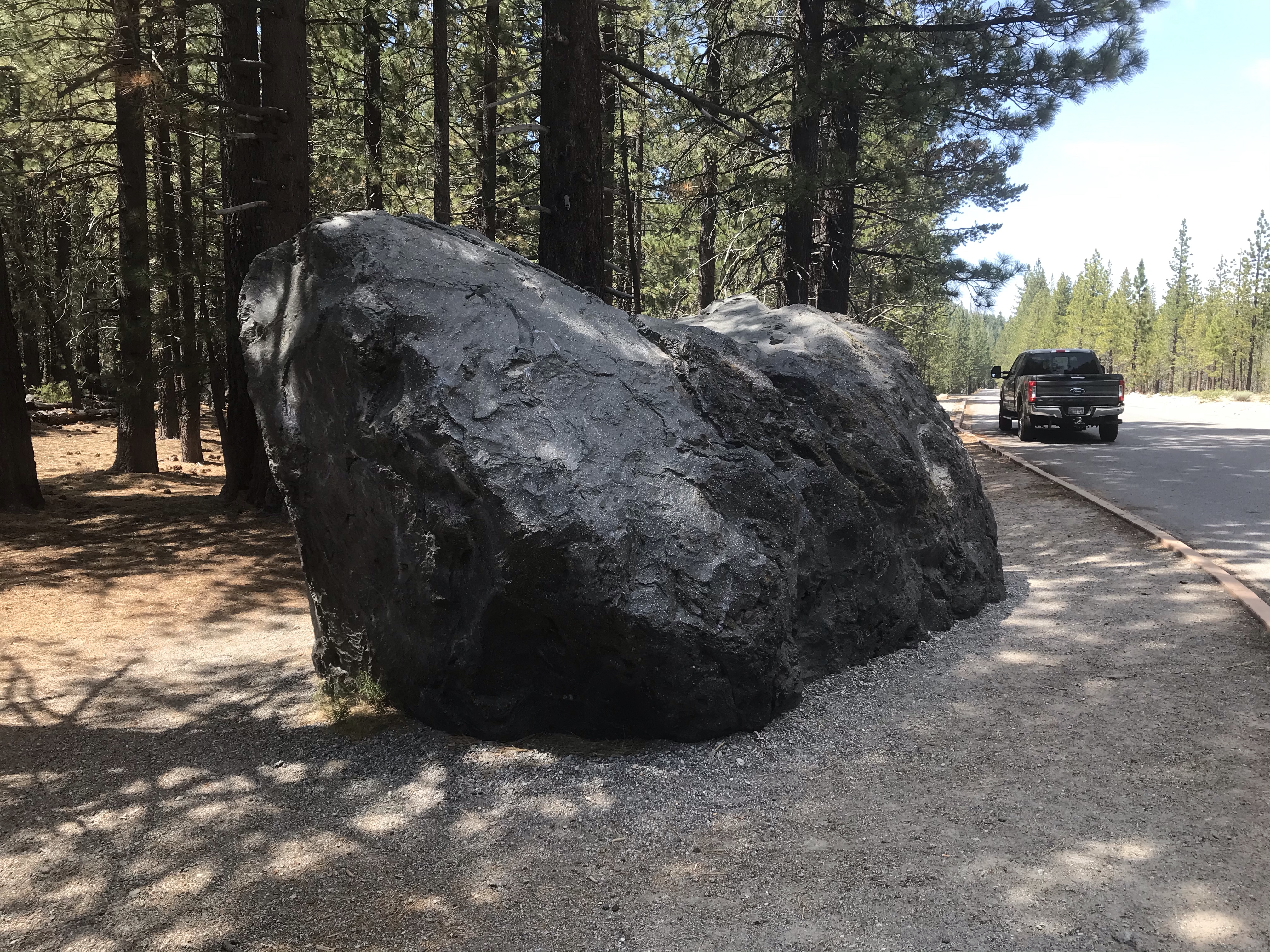
Hot Rock — Famously photographed by B. F. Loomis after the 1915 eruption, this large boulder was swept five miles down the mountain in a snow avalanche. It is said to have been too hot to touch for days after the eruption.

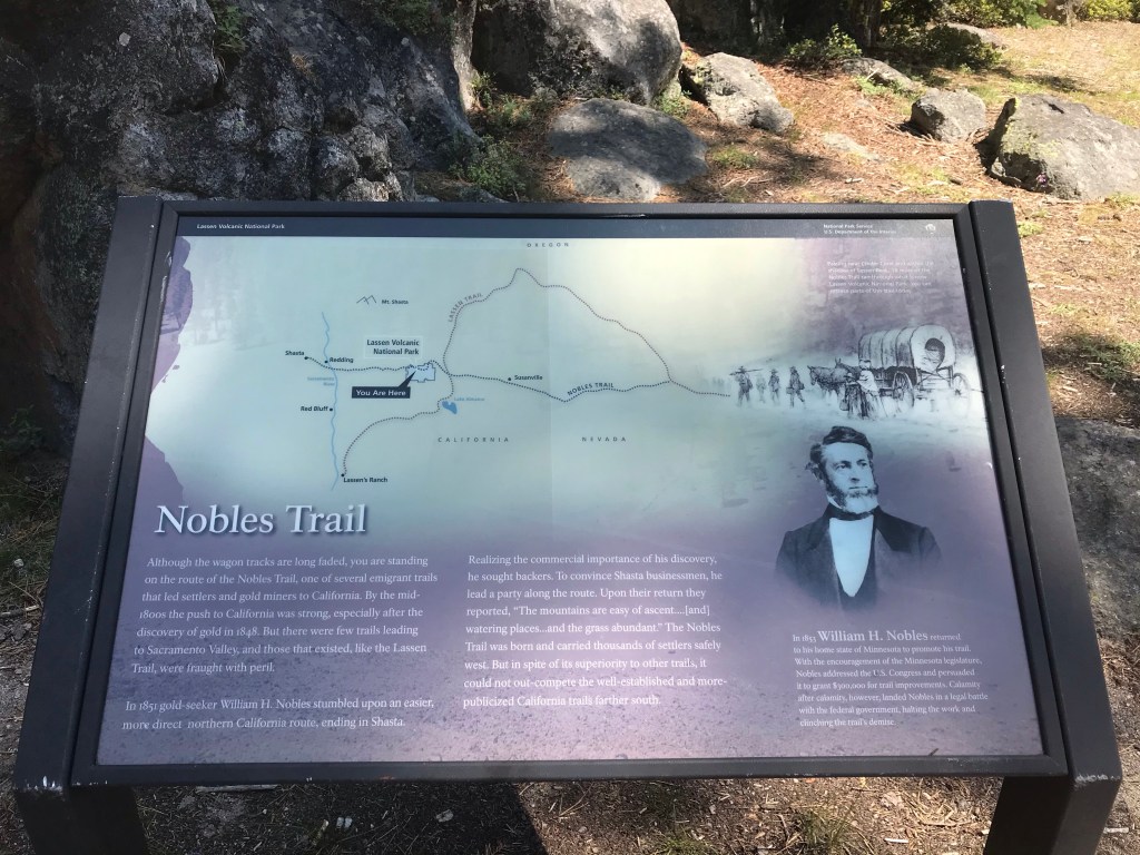
Nobles Trail — For the history buffs, this is a site where you can see where an old emigrant trail lead settlers to California.

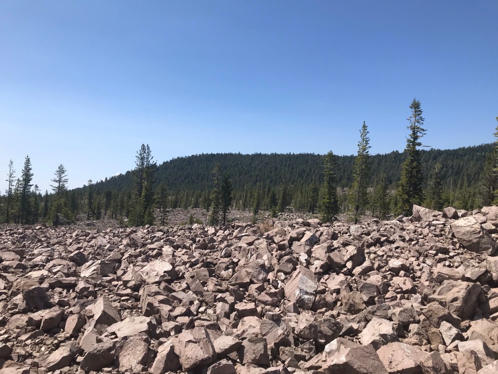
Chaos Crags and Jumbles Scenic Pull-out — Tons of rubble from a landslide created this large jumble. A plaque describes a scene where the 1915 eruption caused an avalanche of rocks and melting snow. It sped down the mountainside with such force it knocked over trees and anything else in the way. The result changed the landscape by blocking streams and creating lakes.
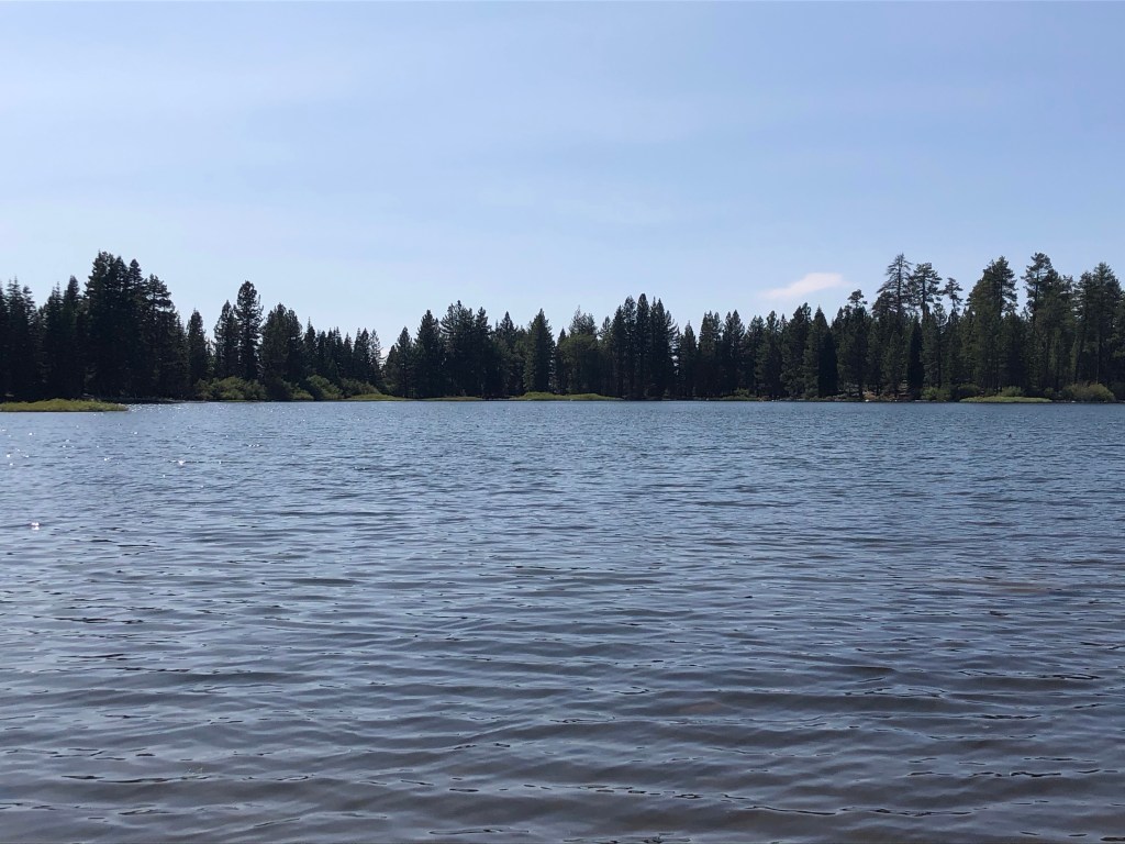
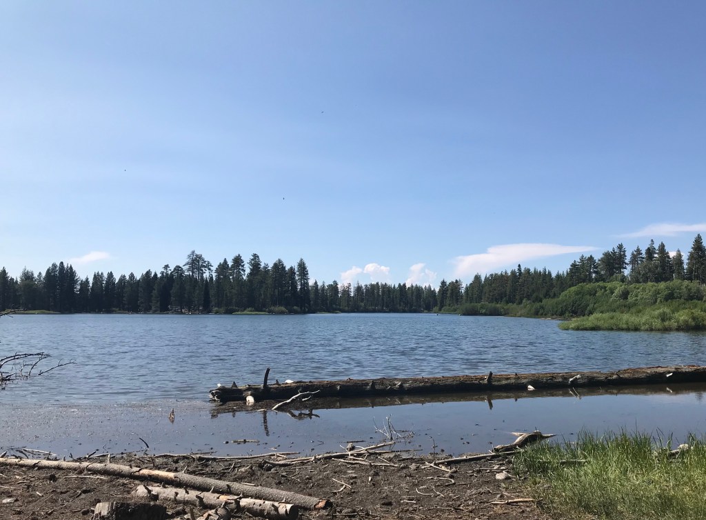
Manzanita Lake — A lake created by the 1915 landslide. It’s a popular lake near the campground where boating, fishing and swimming are favorite activities. We walked down to the water to take a look and started walking along the shore. We saw a sign warning that the lake was closed to swimming. Apparently, an otter with young pups recently attacked a swimmer sending them to the hospital.
There are three additional roads going into the park to other more remote areas. We spent a day exploring one of those areas. We drove an unpaved road to a trailhead where we hiked to a remote hydrothermal area. It was a beautiful 4.6 mile round trip hike. Starting at the trailhead we went along Hot Spring Creek crossing over a series of footbridges and boardwalks before crossing a lovely meadow.
We entered a wooded area where we climbed more than six hundred feet to Devil’s Kitchen. It’s the second largest hydrothermal area in the park. There wasn’t a boardwalk here like at Bumpass Hell, rather a marked trail with signs warning of the dangers of going off the trail. We saw a deer who obviously didn’t see the warning signs nibbling on green grass growing near the hot springs. We enjoyed this hike as it has a variety of landscapes in a remote area of the park. We walked around Devil’s Kitchen for about thirty minutes and didn’t see another soul until we started our hike back.
Having seen many of the more visited sites and even working in a remote adventure, we left satisfied with our stop at Lassen Volcanic National Park. Of course there is much more we could of done like hike to Lassen Peak or explore an underground lava tube. We could of stayed a couple of more weeks. But this is a big country with tons of amazing places. It would take more than a lifetime to see it all. So we’ll keep moving to more places with more to see.
So until next time…happy days and safe travels.

I doubt we will ever get there now at our age. So your updates at lease gives us a picture what beautiful things are out there. Thanks for taking the time to allow us to be a part of you adventures.
LikeLike
This was a very interesting post. Maybe we will get there someday. If we do, we will be sure to drive the 30 mile loop and take the hikes you talked about. Have a good day tomorrow.
LikeLike
Thank you for the kind comment. I hope you do get to visit one day. It was one of my favorite parks so far.
LikeLiked by 1 person