Learning about a new area we’ve traveled to can sometimes be a challenge, especially when we only have a few days there. Normally, one of the first things we look for is the local visitor center. They are filled with brochures and maps to all the points-of-interest. Most of the time there is an information desk with a friendly person eager to answer questions and make recommendations. They are so helpful finding the must see things-to-do and many times offer tips on lesser known out-of-the-way places that only the locals know about. Unfortunately, we are finding visitor centers closed with signs posted stating “Due to COVID-19, we are closed until further notice. Sorry for any inconvenience this may cause.” Yuck! This is an inconvenience.
Of course, there is Google. You can search an area and find things to see and do. Social media is helpful. Following certain groups on Facebook and posting questions can elicit responses to a lot of things such as “Where is the best campground here?” or “Where is the best restaurant near there?” or “What should I visit while in this place?”.
One of the social media forums I thought would never be of any interest to me was Pinterest. However, I signed up a while back after a fellow RVer recommended it as a great resource for discovering things to do. Admittedly, it is now my go to online resource for researching a new area for things to see and do.
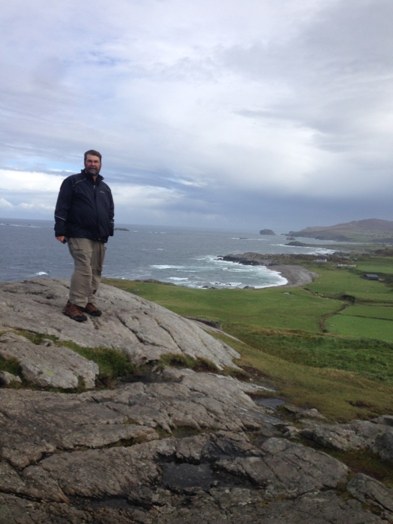
The best resource any of us has is people. Striking up a conversation with fellow campers or asking questions of the locals or even a waitress when she brings out your meal can lead to some of the best recommendations of all. Case in point: on a trip to Ireland a few years ago we drove to the island’s northern most point, Malin Head, on a recommendation from a waitress in Londonderry. It turned out to be an exciting and beautiful place and was one of the most memorable drives we’ve experienced during our visit.
2017
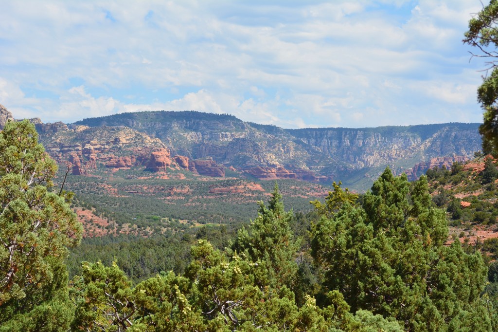
We made use of all these different resource when looking for hikes near Sedona. The one hike that kept coming up over and over again was the hike to the Devil’s Bridge. It was consistently listed on Sedona’s top ten hikes. So one morning we packed some water and some food and took off for the trailhead.

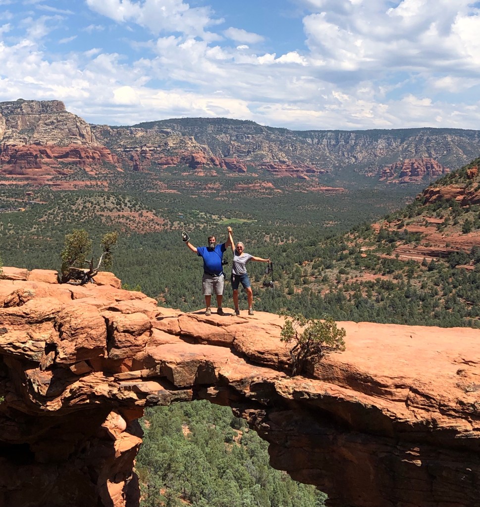
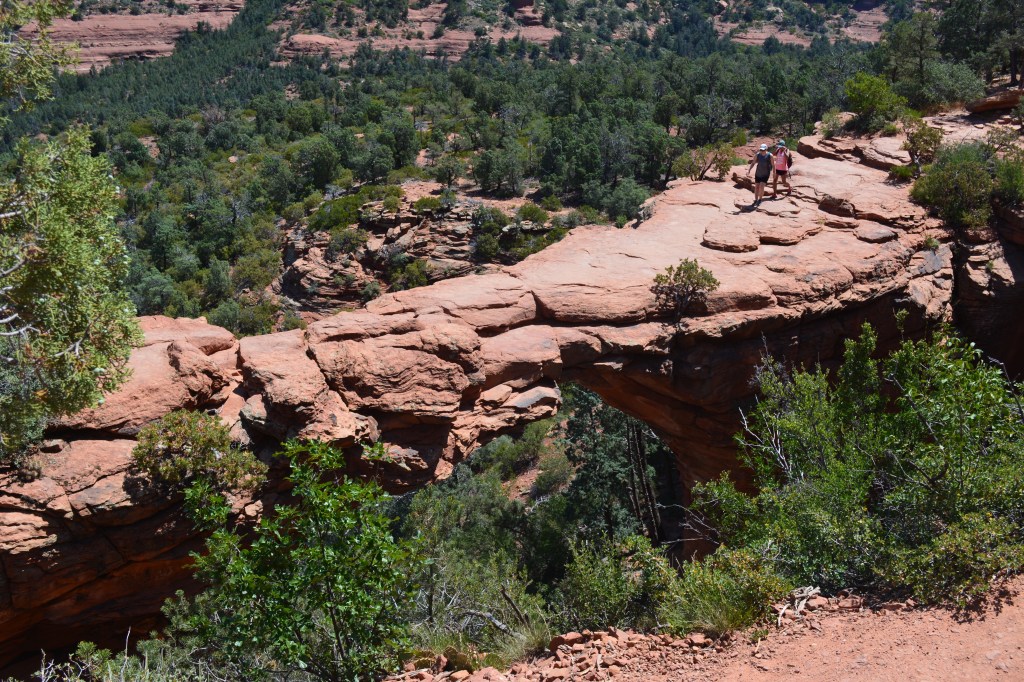
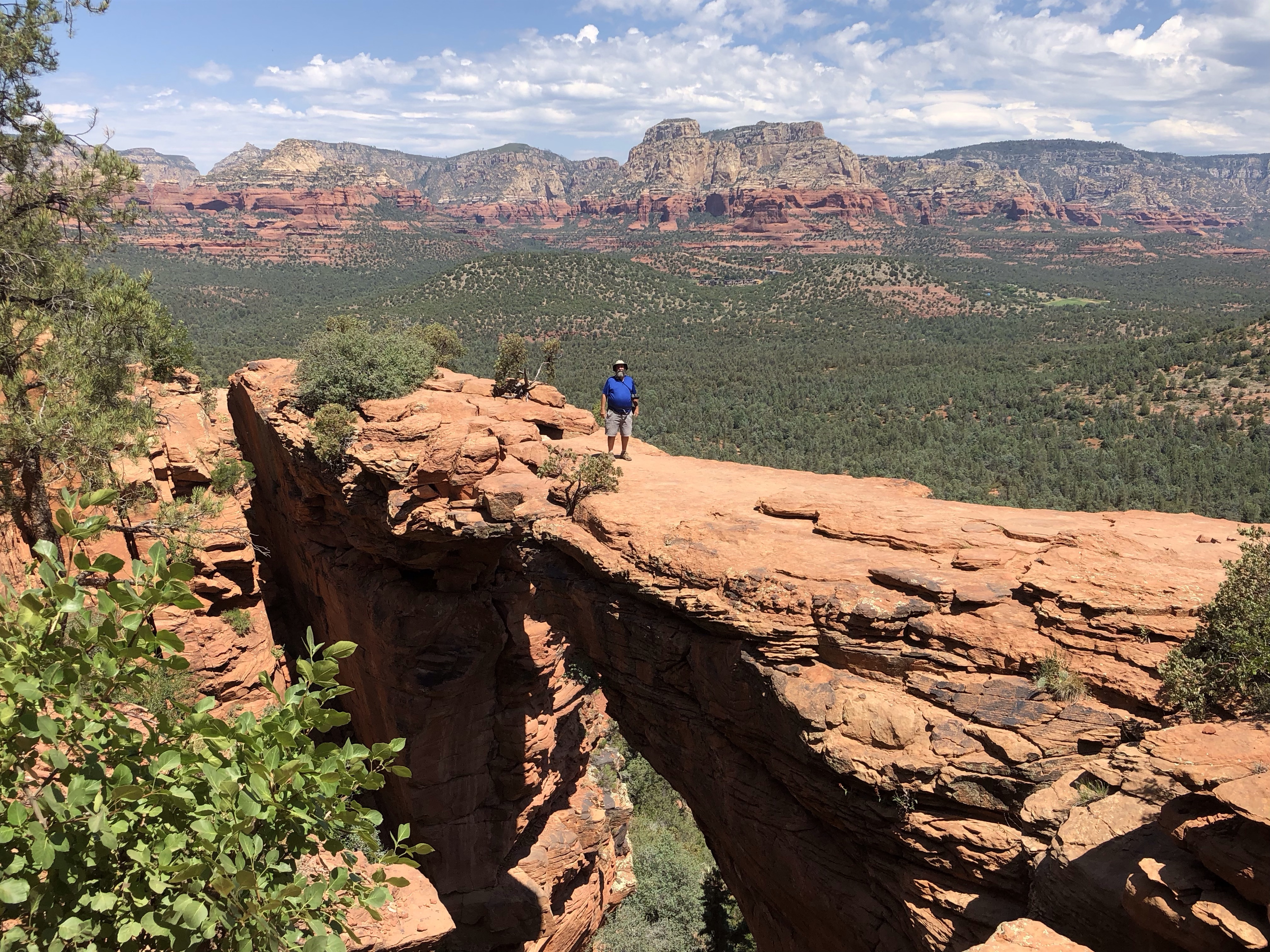
Devil’s Bridge is a large natural sandstone arch offering breathtaking views. At 0.8 miles from the trailhead and a mere 400 feet climb in elevation, the hike is rated as moderate difficulty. But by all reports the reward is worth the effort.
What we knew before we arrived: This is a popular hike. Parking is limited so arrive early. A four wheel high clearance vehicle was needed to get to the Devil’s Bridge Trailhead parking lot where there is only a handful of spaces to park otherwise park at the Devil’s Bridge Trail parking lot or the Mescal Trailhead parking lot. Take plenty of water (one gallon per person for this hike). To avoid the heat of the day, start early.
Okay, so did we arrive early? Not unless you call 9:30 AM early. Did I take advantage of our 4×4 truck to go to the Trailhead parking lot? No! A first look at the rocky uneven jeep trail heading up caused me to have second thoughts. “I’m not taking my $60,000 truck up that road”, I thought to myself. Besides, what if I get up there and find there’s no parking left. I’d have to drive back down wasting valuable time before the real heat starts kicking in. Well…this turned out to be a mistake as I later learned I could of easily made it to the trailhead. Instead, we circled the Devil’s Trail parking lot until we found someone getting ready to leave. We sat there until they pull out and took their spot. Did we bring enough water for this hike? We each had one 16 ounce bottle of water. Were we ready for a 4.2 mile hike with 100 degree temperatures? Probably not, but Devil’s Bridge…ready or not, here we come.
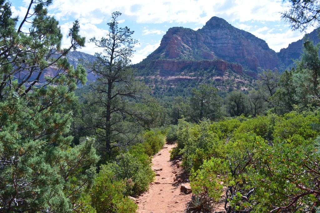
Because we parked in the lower Devil’s Bridge Trail parking lot, we added an additional 2.4 miles to our overall hike. We began by hiking a portion of the Chuck Wagon Trail up to a point where a short side trail lead to Dry Creek Road. This was an easy, mostly level section through the juniper trees. Next we followed the road going toward the trailhead. Having no shade, this was the most unpleasant part of the hike. The combination of rocky road bed and soft powered red sand which was thrown into a dust cloud every time a four wheel vehicle passed made me regret not making the drive myself.
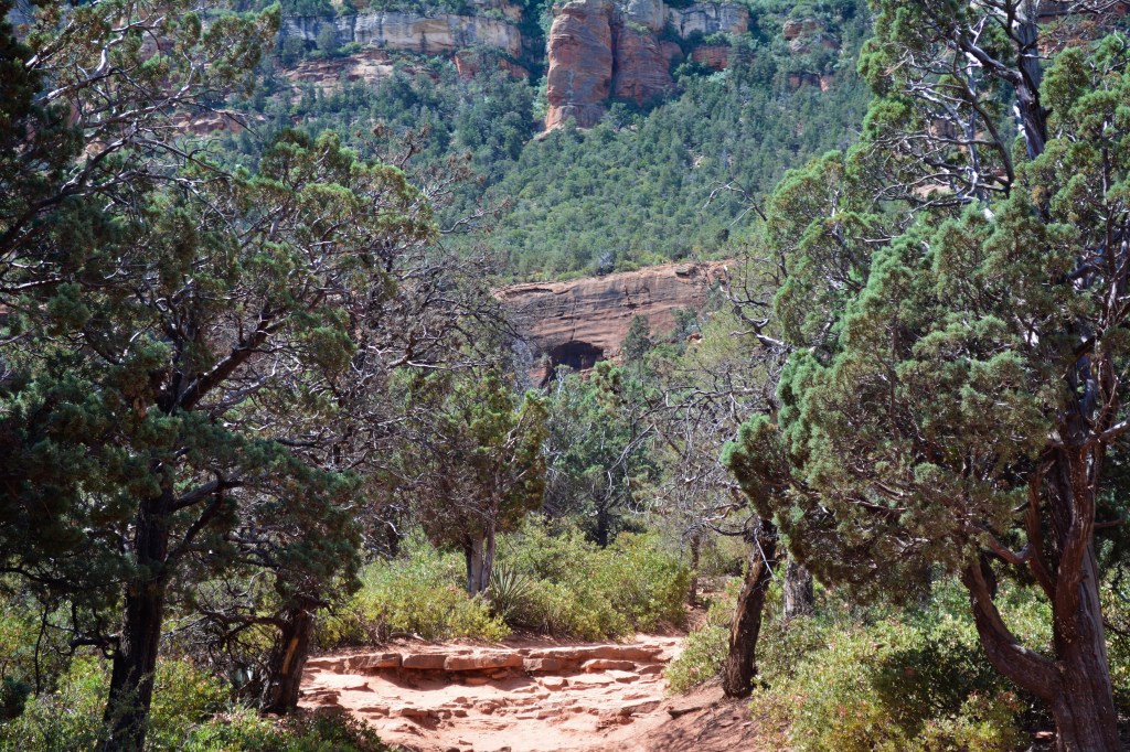
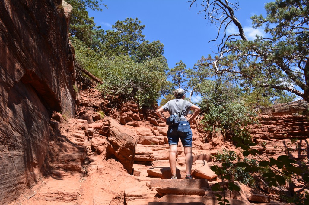
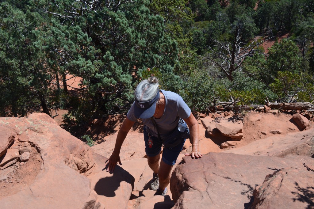
Once we made it to the trailhead I saw there was maybe seven parking space. There was only one spot available but that was all I needed…right? Anyway, the hike from the trailhead was the most challenging part. An uphill trail eventually coming to a kind of rock scramble or natural rock stairs at best. It was at the point that the spectacular views from the trail was starting to appear. There were areas where you could see the valley and distant mountains. We stopped to take in the view and snap some pictures but mostly we stopped to catch our breath from the strenuous climb.
Once we achieved our destination and took one look at the red sandstone bridge, we knew immediately it was all worth it. No wonder this is so popular. We heard there are days when there are long lines of people waiting to climb up and out onto the bridge for a photo. I’m not sure why, maybe it was our lucky day, but there really weren’t that many people here. Most likely because the early crowds were already going back to the parking lot. There was only a couple of people waiting for their iconic bridge photo. We got ours.

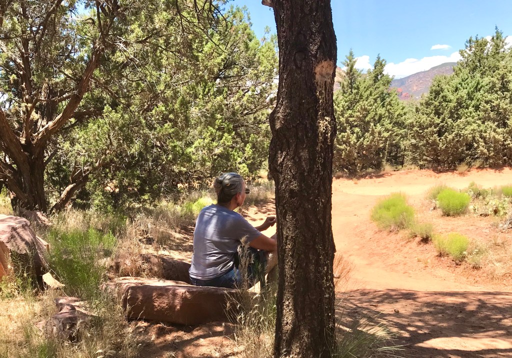
We sat on the rocks under the shade of a juniper tree for maybe 45 minutes or so admiring the site while eating our snacks and drinking our bottle of water. We chatted with some of the other people around finding out where they were from. As we looked around it occurred to us that we were the oldest people there. Glad to know we can still hang with the younger folks. We certainly weren’t the fastest climbers. but we made it just the same.

Of course we heard there is a energy vortex here. Maybe I felt it this time. It felt peaceful…a brief escape from a troubled world. I felt happy to be in a place so beautiful. I was moved and over-whelmed by its awe-inspiring and unique magnificences. I felt humbled and minute in its vastness. If these feelings come from being in a energy vortex then I admit I experienced it. But I can’t say for sure where it came from.
Hiking back down to the trailhead was much easier than the climb up. The hike along Dry Creek Road was brutal. Temperatures were nearing the 100 degree range. We found a rock just off the road under a shade tree where we sat and finished our last bit of water. It was then we knew for sure we should of carried more water. We had more water at the truck. We just didn’t want to carry it with us. When we arrived back at the parking lot it was around 1:00PM. We started the truck and cranked up the air conditioner. We drank all the extra water we brought. We were spent, exhausted, overheated and thirsty. We took note that we probably shouldn’t attempt a hike much longer than this one without being better prepared. We sat in the truck recuperating for a few minutes before driving away.
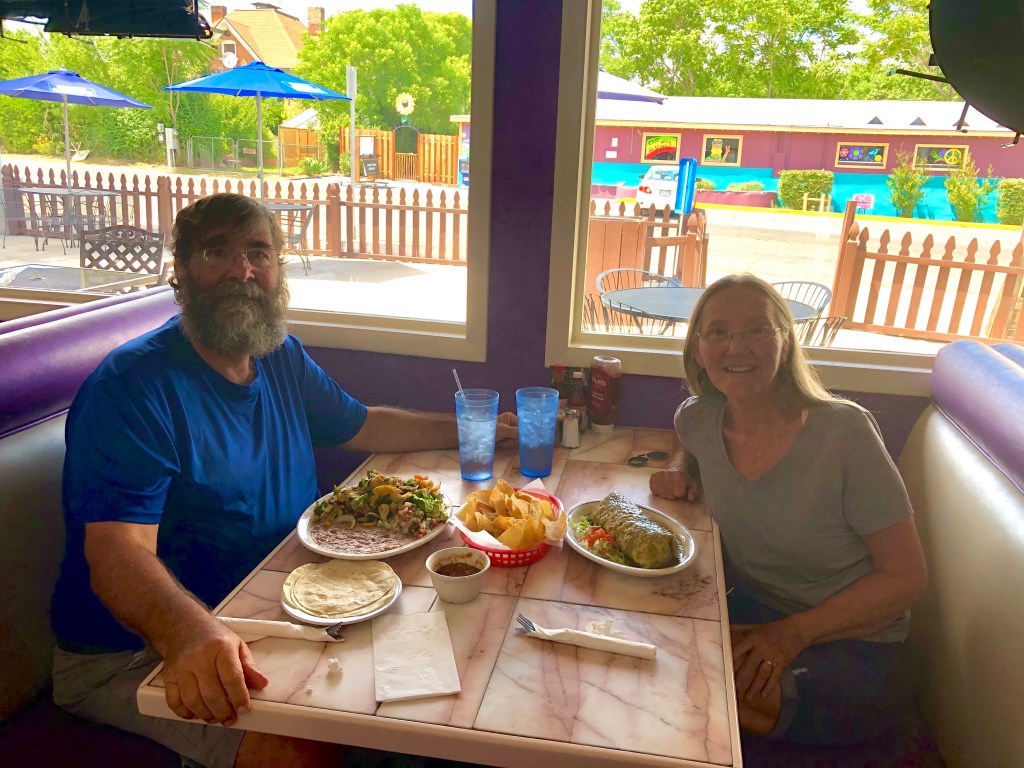
We went to our favorite Mexican restaurant, Adriana’s, for lunch and then back to the camper where we spend the rest of the day laying around in the A/C and chilling out. It was a rewarding hike, one I would do again in a heartbeat. Grammi and I enjoy days like this. The feeling of accomplishment is amazing.
There is more adventures yet to come from this amazing area so check back soon.
So until next time…happy days and safe travels.

Well based on your hiking I’m convinced I’m now to old to deal with the heat and effort require to make the climb. But I enjoyed hearing about it and seeing the pictures.
LikeLiked by 2 people
There is still much to see and do, no climb required. Hope you get out a give it a try. BTW the weather seems to change often. After a week of 100+ highs, today was 86/56. We were hunting the jackets this morning.
LikeLiked by 1 person