In the early years of our country, frontier boatmen floated flat boats down the Ohio and Mississippi Rivers with cargo to markets in Natchez and New Orleans. They would sell everything, including the logs that made the boats, and then return to the Ohio valley on foot. The path they took northward was a well established Indian trail know as Natchez Trace.

The Natchez Trace Parkway is a National Parkway maintained by the National Park Service that commemorates and preserves sections of the Old Natchez Trace. It is 444 miles of two lane road closely following Old Natchez Trace between Nashville, Tennessee and Natchez, Mississippi. No commercial vehicles are allowed on the road. Driving on it reminded me of driving the lower elevations of the Blue Ridge Parkway. It’s amazing how beautiful a road can be without billboards and drive-through restaurants on every corner.
We’re parked at Natchez Trace Campground in Tennessee. It’s another Thousand Trails site so we are still taking advantage of that free camping. We are however sacrificing the scenic views and spacious campsites.
On the day we arrived and after getting the camper set up, we ventured out to explore some of the Natchez Trace Parkway. There are numerous historic sites posted along the parkway with pull outs for stopping and exploring. We stopped at Napier Mine (381.8). Trees have reclaimed the area once occupied by workers with picks and shovels. To me, it looked a lot like a hole in the ground.
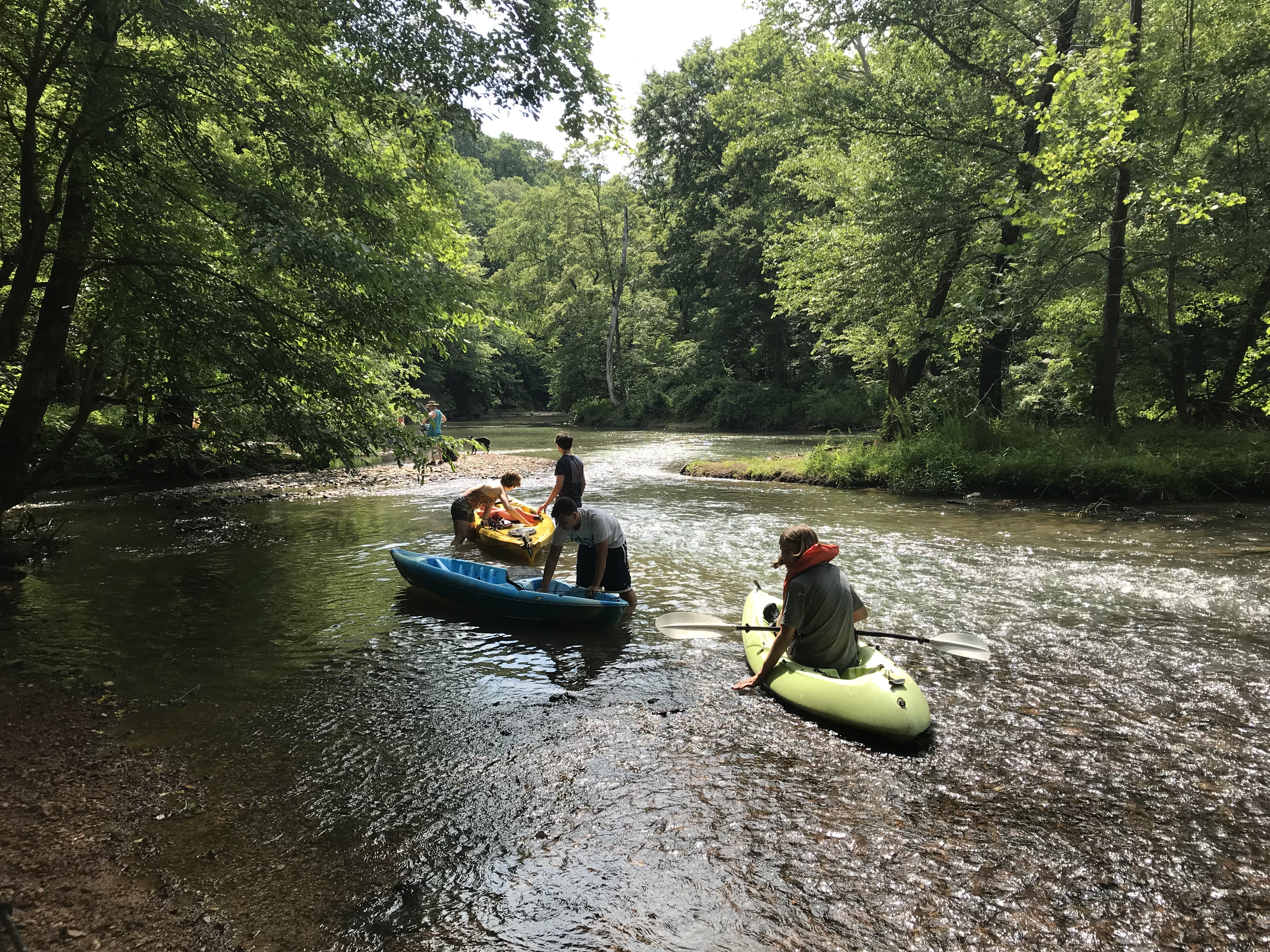
A mile further down the road was Metal Ford (mile 382.8) , a shallow place in the Buffalo River where we found children swimming and playing in the water. A dog was playfully retrieving a ball that his owner tossed into the river. A van arrived and let out a group that launched kayaks for a trip downstream.
Standing near the bank was a gentleman we learned was from Town ‘n’ Country, a suburb of Tampa, Florida. An area not far from our home. He and his wife own a cabin nearby and have been spending their summers here for many years. He gave us some tips and recommendations for the area. One of which was Amber Falls Winery and Cellars.
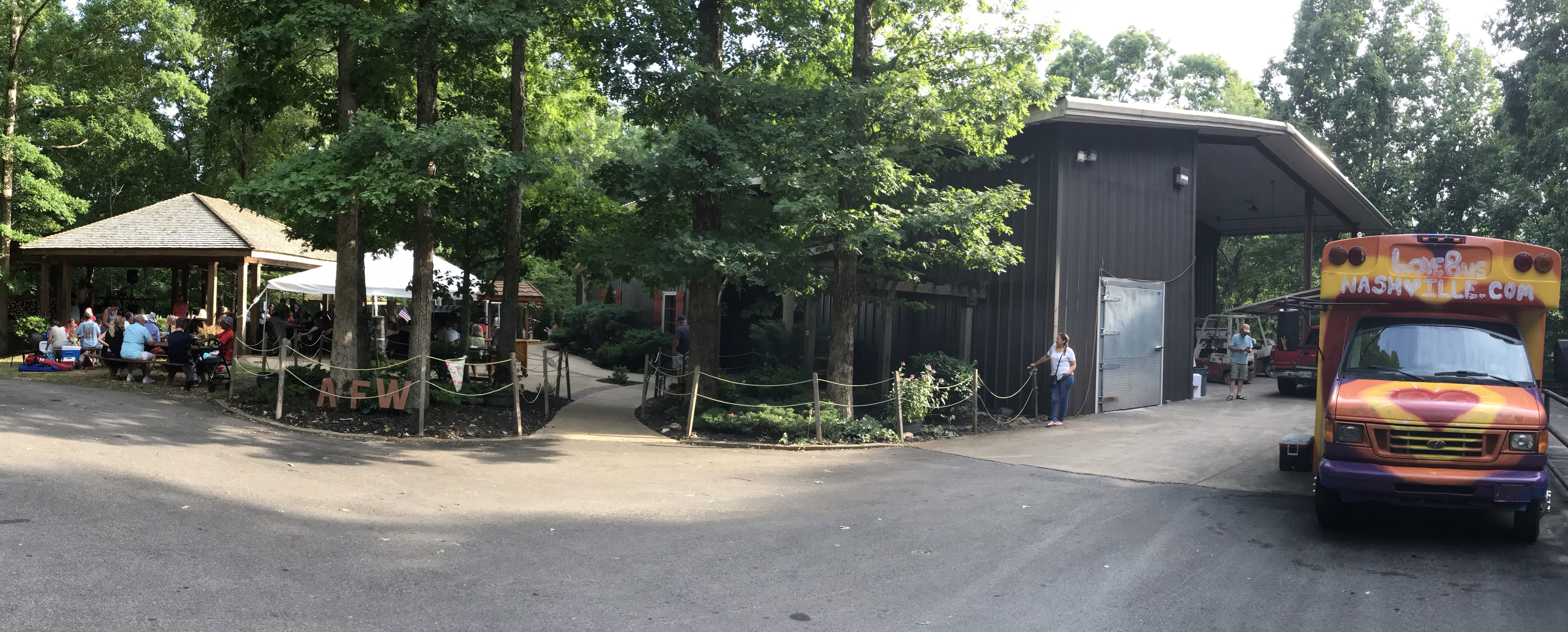
This was a great recommendation and we were thrilled when we arrived to find an outdoor area with a covered pavilion and a live band playing. People were sitting at tables sipping wine and listening to the music. Some were dancing and singing along. A food truck was parked nearby with vegan options on the menu. Wow, this place rocked.
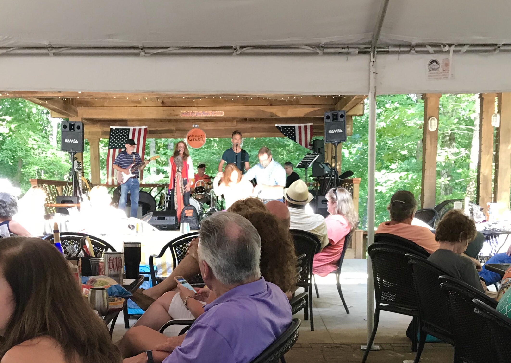
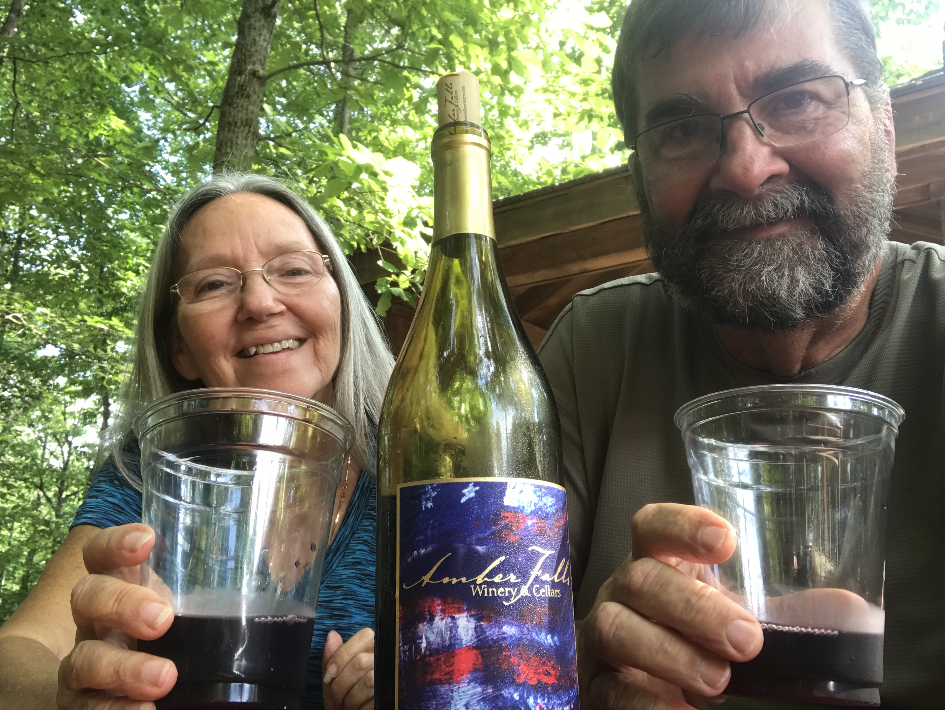
Downstairs was the tasting room. They had a large selection of wines to choose from. They were all made and bottled on site. Grammi and I selected six to sample. We chose to buy a bottle of the Patriot red, a wine somewhere between the sweet that grammi likes and the dry that I like. That’s called compromise, you know, where nobody gets what they really wanted… Well it works for us. The band was very good. They were playing a variety of oldies, rock and country. We sat and listen and enjoyed our wine. It was a good time.
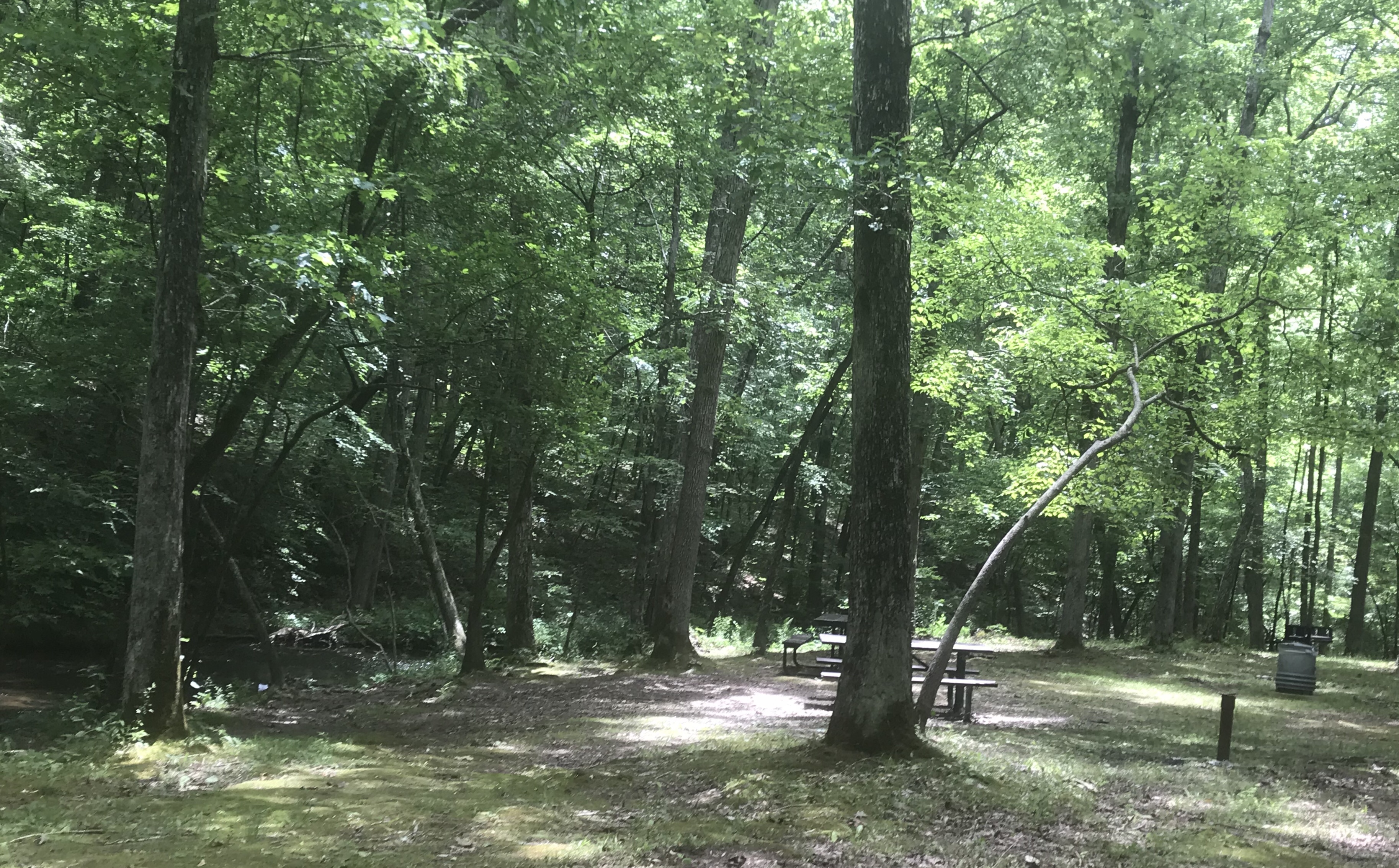
The next day we were back on the parkway. The weather was perfect with temperatures in the low 80’s. We spent nearly the entire day pulling over and exploring nearly all the points of interest along the way. We stopped for a picnic lunch at Jack’s Branch (mile 377.8) where stone steps lead down the valley to tables shaded by tall trees near a stream. There were maybe a dozen picnic tables but we were all alone in this beautiful place. Occasionally we would hear a car pull into the parking area. The folks would get out and look down at us, but nobody attempted the climb down the stairs.
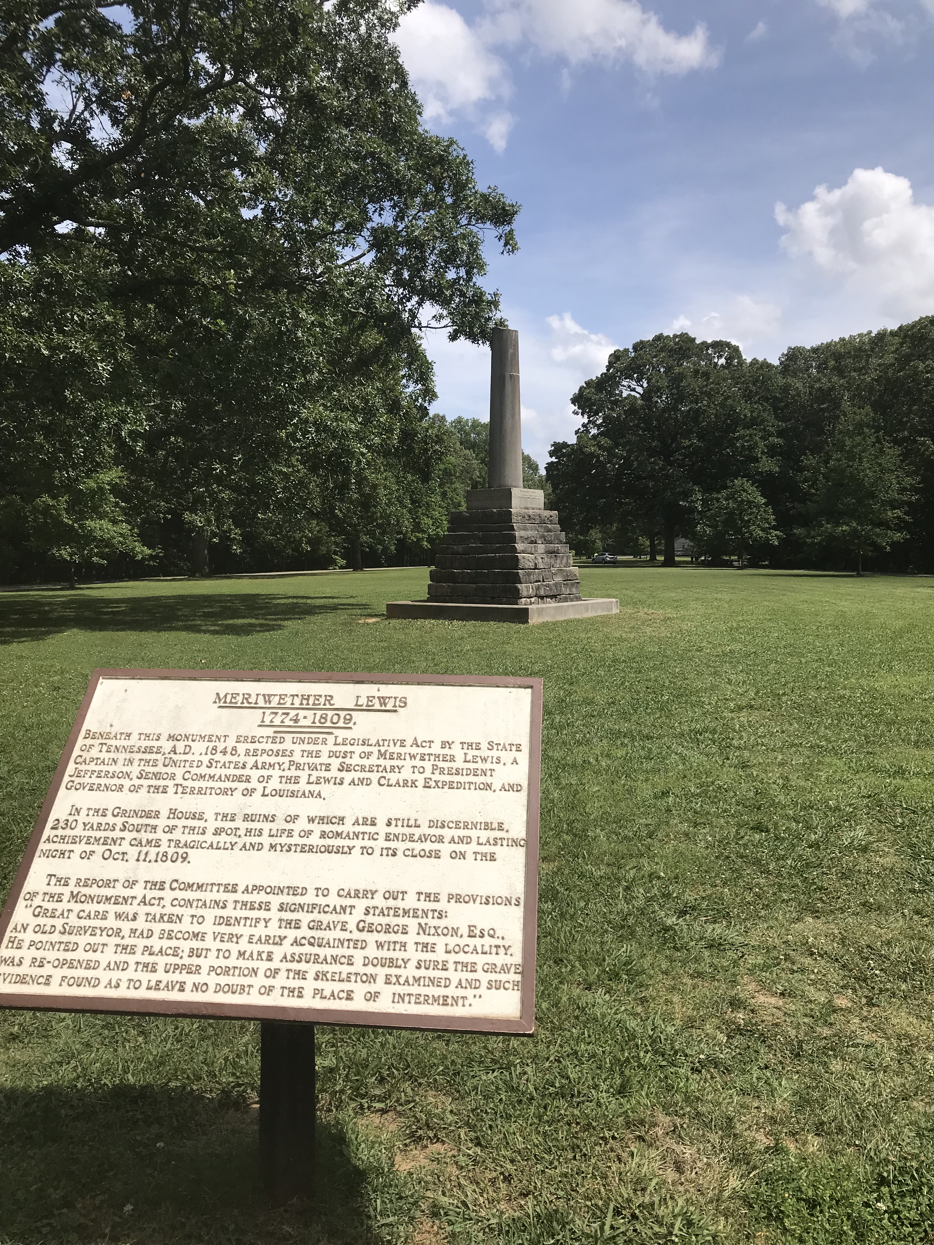
We stopped at Meriwether Lewis Site (mile 385.9), one of the larger points of interest and recreational areas on the parkway. Here was located a campground, picnic area, hiking trails, exhibits, restrooms and a monument at the gravesite of famed explorer Meriwether Lewis who died nearby in 1809 while traveling the Natchez Trace to Washington, DC. Some years back I read his journal about the Lewis and Clark expedition. He was an educated frontiersman who has provided a glimpse of history through his writings.
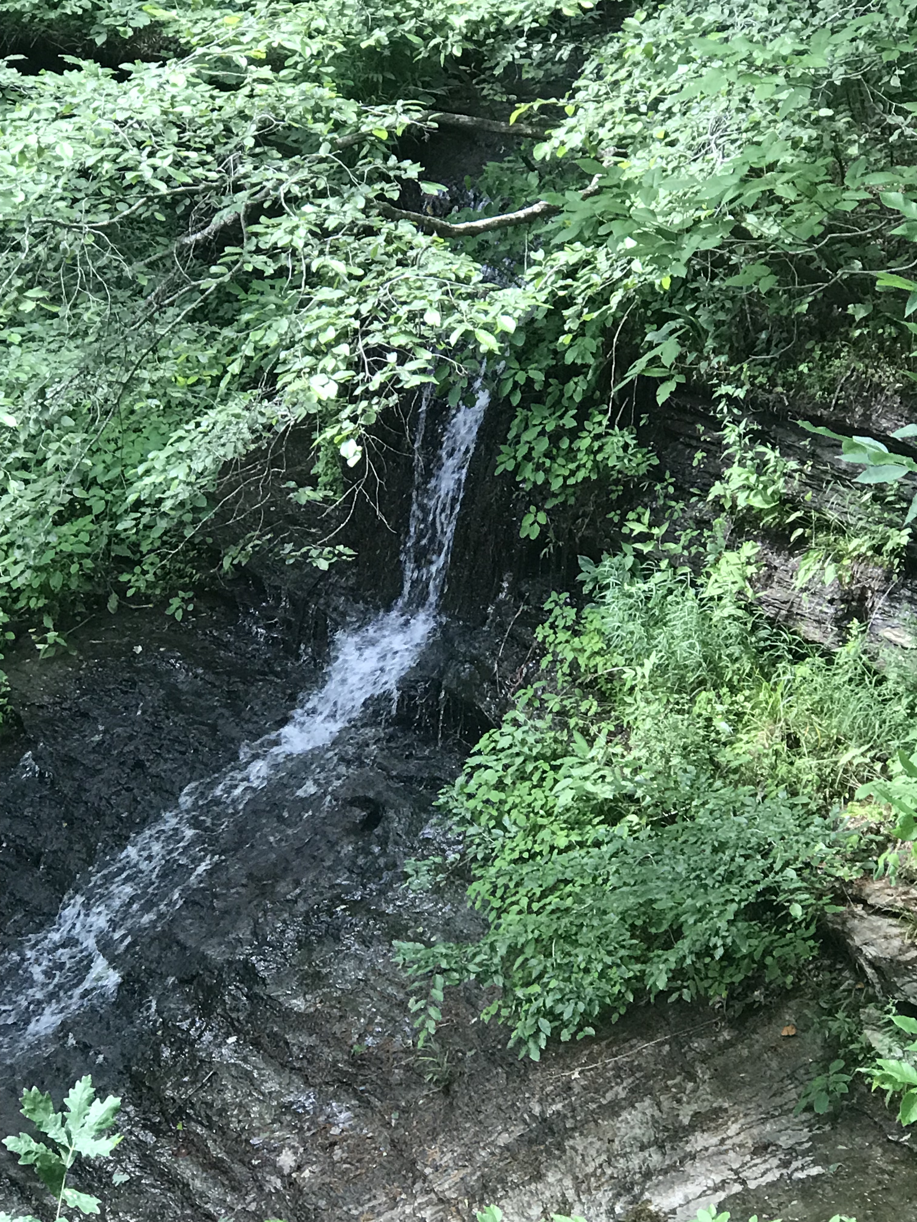
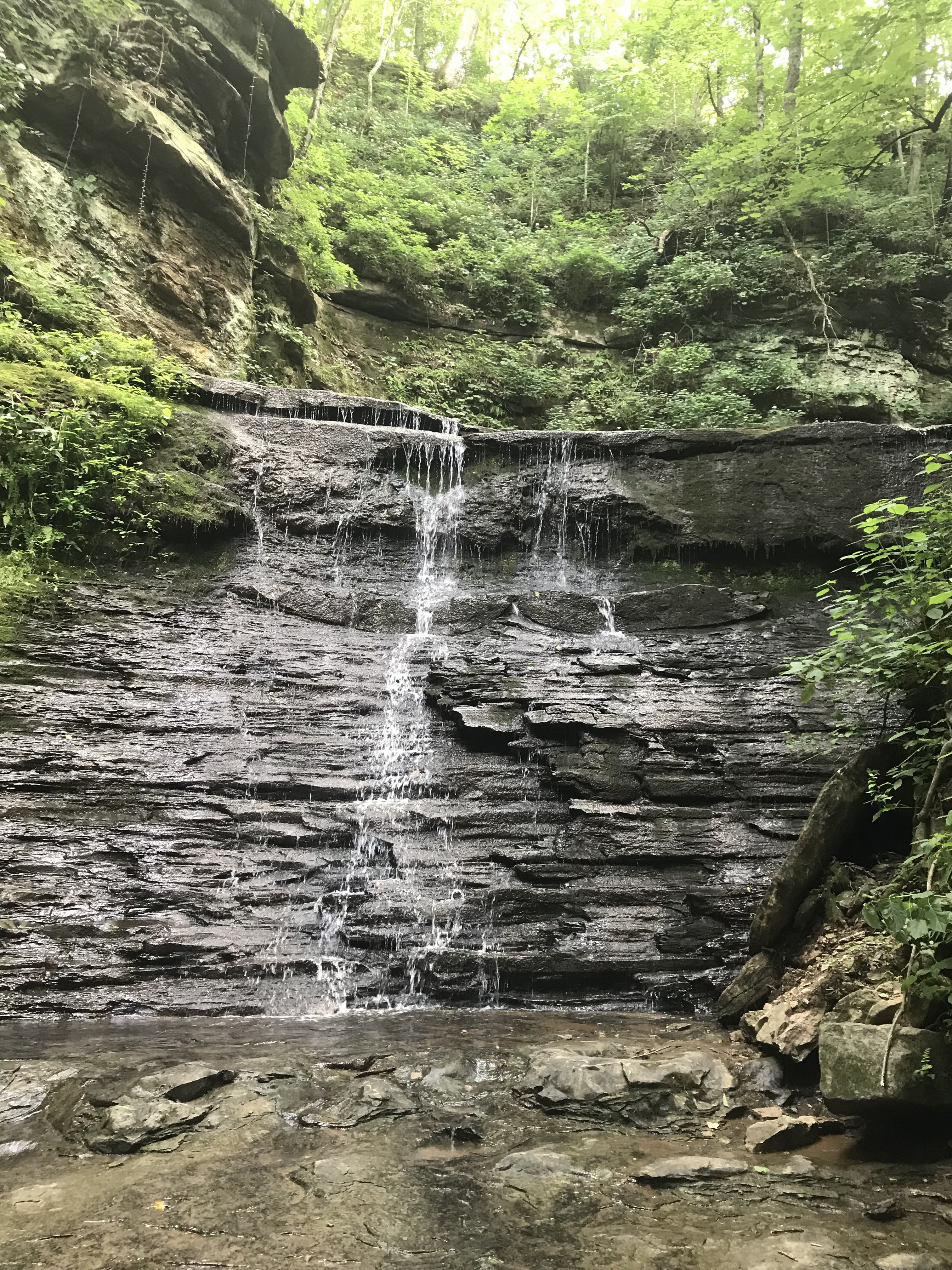
We stopped at Fall Hollow (mile 391.9) and found a walk down to an overlook with a view of a waterfall. Although it was a lovely area with lots of trees and sounds of water splashing against the rocks, it was small and disappointing as far as waterfalls go.
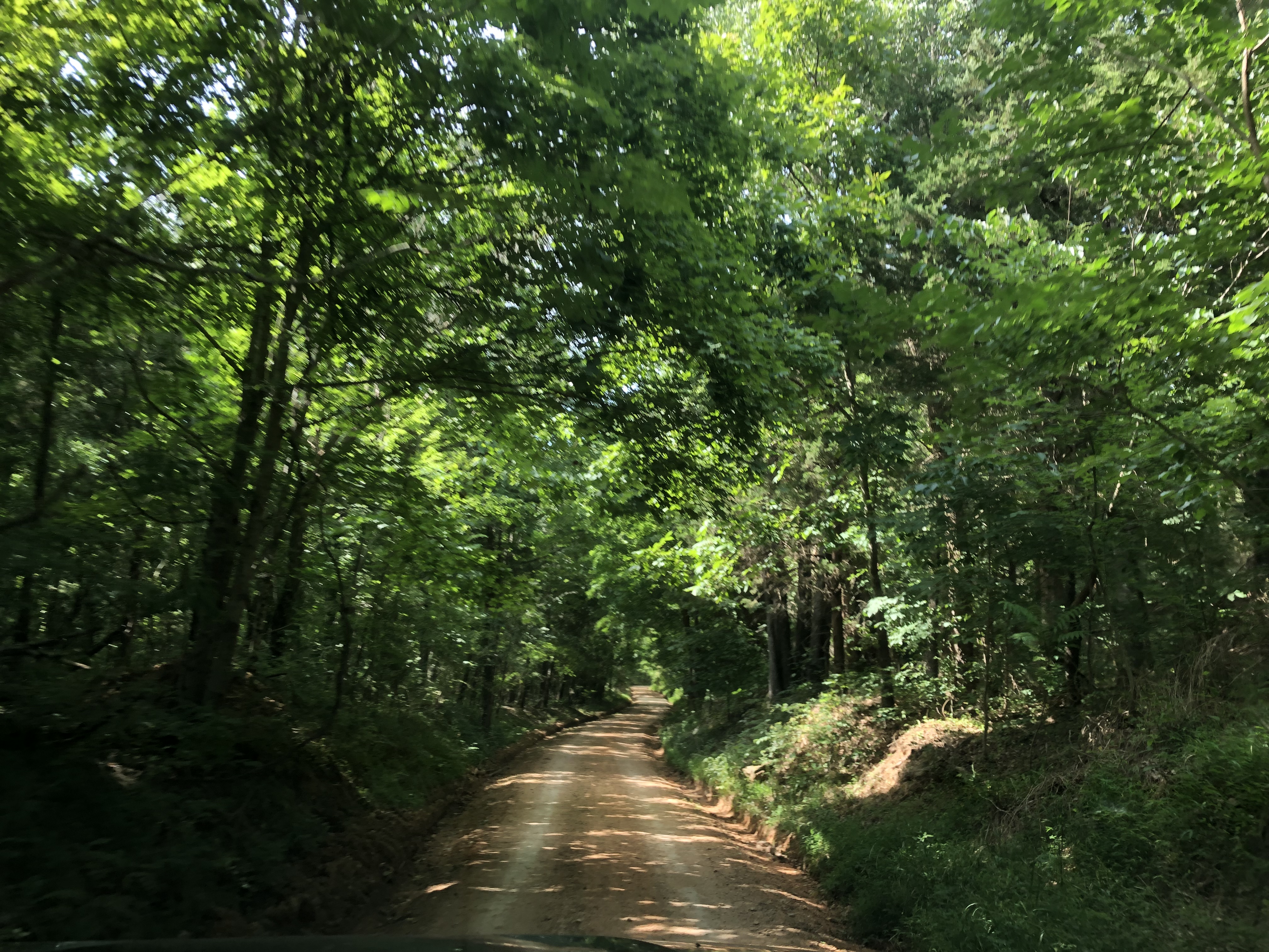
At the Tobacco Farm (mile 401.4) we started a one-way two mile drive along an original section of Old Trace. We slowed down and lowered our windows trying to get a sense of what it may of been like for travelers in the early 1800’s. However, with the noise of the diesel and the smell of exhaust we quickly rolled the widows up and continued on our way.
The highlight of the day was Jackson Falls (mile 404.7). The path leading to the falls was only 900 feet from the parking lot but it was steep. The climb out was strenuous but it was worth it. This fall was much bigger and much more beautiful than Fall Hollow. There was a rush of water pouring over an upper falls cascading down to yet another lower fall. We spent probably thirty minutes there climbing over rocks and snapping pictures.
The next morning as we were driving out for another day of adventure, we saw Tom and Ester driving by. Toot! Toot! Tom looked around wondering who in the world was honking at him. We met Tom and Ester maybe three weeks ago at Bear Creek Campground. They are full-timers in a thirty-six foot Mobile Suites fifth wheel. We said hello and agreed to get together a little latter.
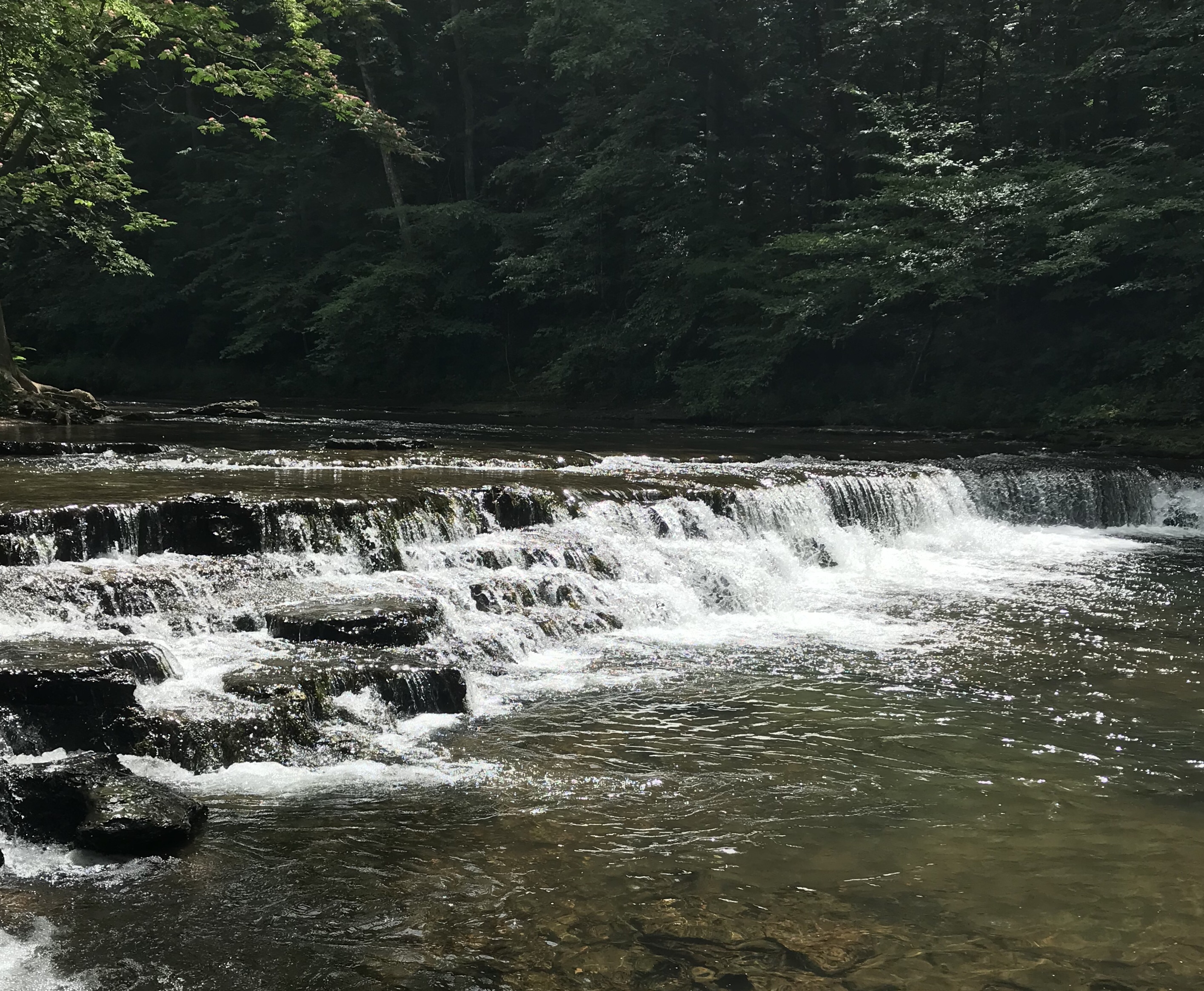
We went on to Davy Crockett State Park. They have a campground that is in a wooded area and seems to be well maintained. There were cottages near the water. We stopped at Crockett Fall. I’m not sure why it’s called a falls. It drops maybe four feet. Isn’t there some kind of official rule on how high a drop has to be before its called a falls? Don’t get me wrong. It’s a pretty place. Great for swimming and climbing rocks in the water, but I think they should call it Crockett’s Little Drop.
The Davy Crockett Museum inside the park was a place where we learned about his life during the time he lived in Lawrence County, Tennessee. It was a fascinating walk through history and quite enjoyable.
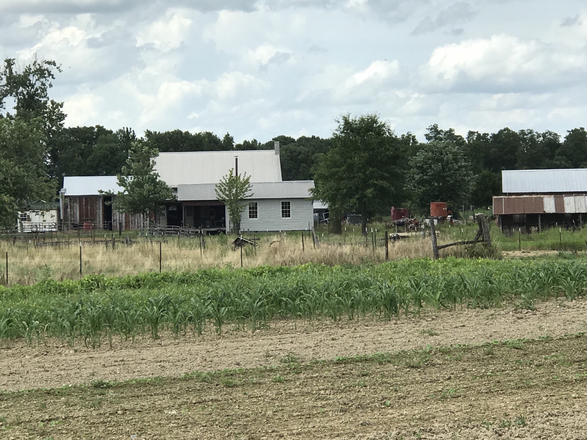
Next we drove to Ethridge where there are about 250 Amish farms in the area. We stopped in at a local store to get a map showing more than fifty of the farms that have things for sale. Everything from fresh vegetables, pickled and canned vegetables, homemade candies, jellies and jams and sorghum molasses, to baked goods and fried pies. There are cutting boards, rolling pins, bird houses, walking sticks, furniture and other hand crafted items.
We have been to this area before, but it’s been about six or seven years ago. We were looking forward to visiting again. Driving around trying to follow the hand drawn map was an adventure. Almost every farm house had a roadside hand painted sign telling you what they have for sale. We would drive up the dirt drive to the house. There was usually a little shed in the front of the house where they sold their goods but some just conducted their business on the front porch.

We drove around for a couple of hours passing horse drawn buggies on our way to the next farm. Part of the adventure was seeing the different farms. There was always small children around all dressed alike. We saw a horse pulling a plow in the field tended by what appeared to be three teenage boys. There was one on the reins, one leading the horse and one steering the plow. We saw young girls in the field tending gardens. It was an intriguing adventure and we ended up with a load of vegetables. We also got a loaf of cinnamon bread, homemade fudge, a jar of honey and a lot more. It was fun and a productive adventure.
Rain came in the night and there was still a light mist in the morning. We heard a knock at the door. Hey, it’s Tom and Ester. We invited them inside, out of the damp, and sat around and chatted for and hour or so. We caught up on where they’ve been and what they’ve been doing since we last saw them at Bear Creek. It’s good to make connections with like-minded people while on the road. We are going to stay in touch and meet up again in December.
We went into the town of Hohenwald, Tennessee about fifteen miles from our camp. Most everyone I talked to called it Hole-in-the-wall though. I was told it was German meaning high forest. We did a little shopping and exploring of the downtown district. We had lunch at the Lewis and Clark Restaurant. Then we returned to our camp for a quiet afternoon before getting ready to pull out in the morning for a new place and more adventures.

What a way to retire. Good health, nice truck, and a good rolling roof over head. And having a plan helps too. One could say the road is your oyster. Travel while you can, again, love the write up.
LikeLike
Thanks Bill, we’re having fun.
LikeLike